Map of the Colville Region, Washington Territory, issued in 1882 by the Northern Transcontinental Survey. The dimensions of the map are 112 x 81 cm, with the overall sheet size measuring 117 x 87 cm. The map features the Colville River Valley and includes surveys of the region. It is a lithograph with imperfections, as sections are missing from the lower left and lower right corners. The map may have been published in Newport, R.I
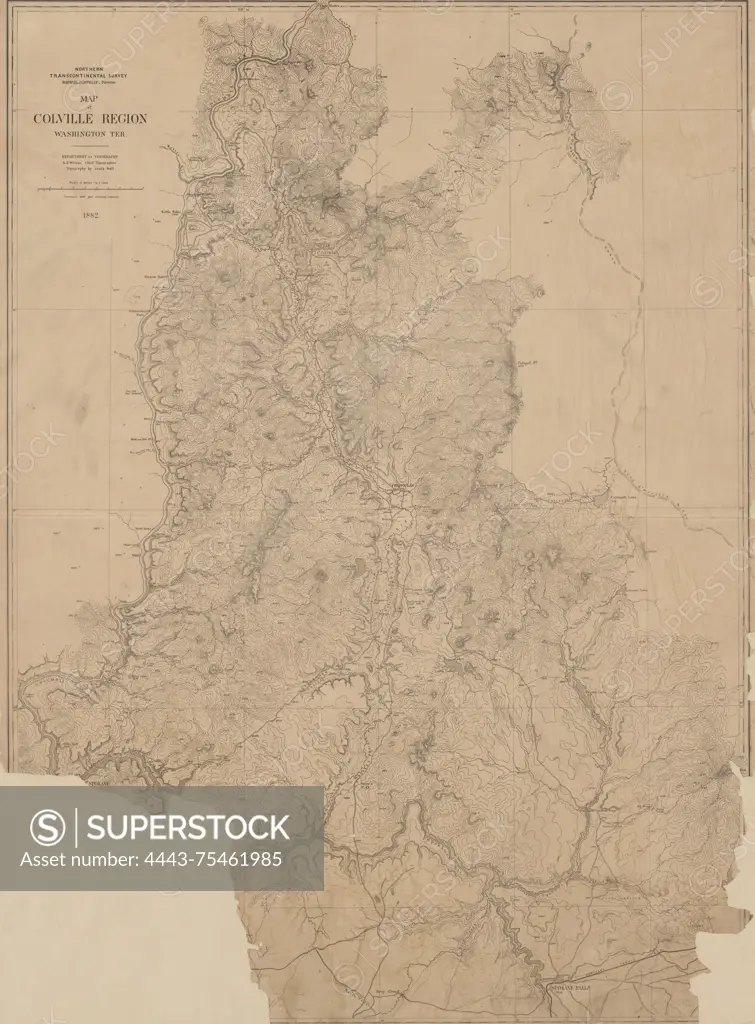
SuperStock offers millions of photos, videos, and stock assets to creatives around the world. This image of Map of the Colville Region, Washington Territory, issued in 1882 by the Northern Transcontinental Survey. The dimensions of the map are 112 x 81 cm, with the overall sheet size measuring 117 x 87 cm. The map features the Colville River Valley and includes surveys of the region. It is a lithograph with imperfections, as sections are missing from the lower left and lower right corners. The map may have been published in Newport, R.I by Artokoloro is available for licensing today.
Looking for a license?
Click here, and we'll help you find it! Questions? Just ask!
Click here, and we'll help you find it! Questions? Just ask!
DETAILS
Image Number: 4443-75461985Rights ManagedCredit Line:Artokoloro/SuperStockCollection:Artokoloro Model Release:NoProperty Release:NoResolution:4206×5700