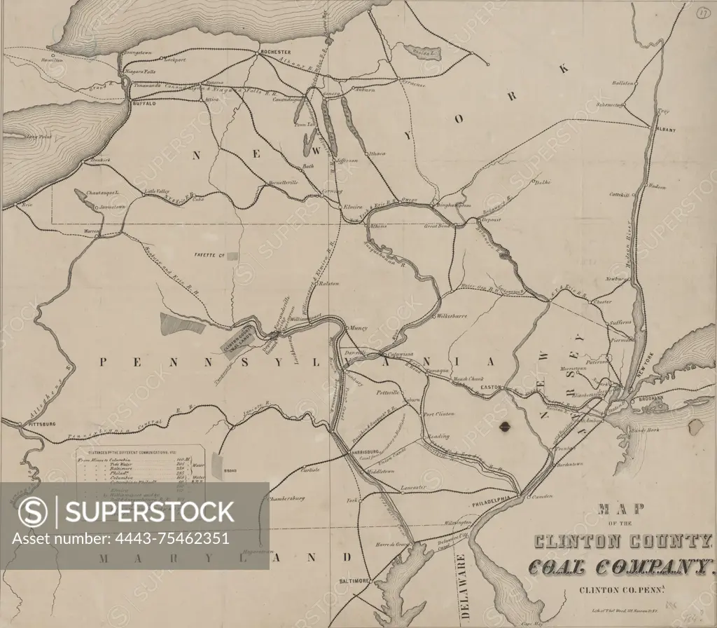
Map of the Clinton County Coal Company in Clinton County, Pennsylvania, created between 1855 and 1856. The map, measuring 45 x 51 cm on a sheet of 50 x 54 cm, details railroads, canals, and coal mines in the Middle Atlantic States. The publisher is not identified
SuperStock offers millions of photos, videos, and stock assets to creatives around the world. This image of Map of the Clinton County Coal Company in Clinton County, Pennsylvania, created between 1855 and 1856. The map, measuring 45 x 51 cm on a sheet of 50 x 54 cm, details railroads, canals, and coal mines in the Middle Atlantic States. The publisher is not identified by Artokoloro is available for licensing today.
Looking for a license?
Click here, and we'll help you find it! Questions? Just ask!
Click here, and we'll help you find it! Questions? Just ask!
DETAILS
Image Number: 4443-75462351Rights ManagedCredit Line:Artokoloro/SuperStockCollection:Artokoloro Model Release:NoProperty Release:NoResolution:5700×4988