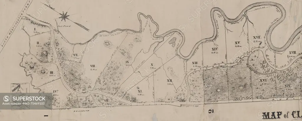
Map of Clasons Point in the town of Westchester, issued in 1868. The map is published in Albany, N.Y. (publisher not identified) and covers Westchester (N.Y.) and the Bronx (New York, N.Y.). The extent of the map is 1 sheet measuring 37 x 156 cm
SuperStock offers millions of photos, videos, and stock assets to creatives around the world. This image of Map of Clasons Point in the town of Westchester, issued in 1868. The map is published in Albany, N.Y. (publisher not identified) and covers Westchester (N.Y.) and the Bronx (New York, N.Y.). The extent of the map is 1 sheet measuring 37 x 156 cm by Artokoloro is available for licensing today.
Looking for a license?
Click here, and we'll help you find it! Questions? Just ask!
Click here, and we'll help you find it! Questions? Just ask!
DETAILS
Image Number: 4443-75469103Rights ManagedCredit Line:Artokoloro/SuperStockCollection:Artokoloro Model Release:NoProperty Release:NoResolution:8524×3433