Map of the City of Stockton and vicinity, depicting the Fair Oaks and Burkett Tracts. Published in 1893 by W.H. Richards, the map measures 41 x 38 cm and is focused on real property and landowners in Stockton, California
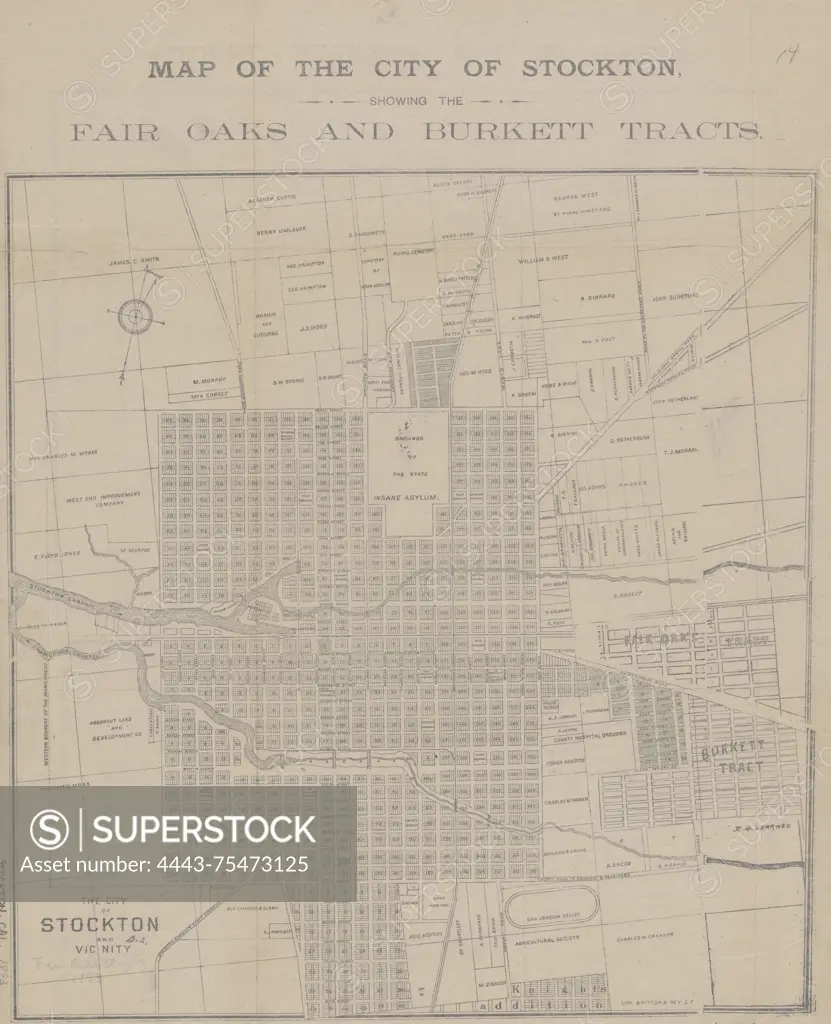
SuperStock offers millions of photos, videos, and stock assets to creatives around the world. This image of Map of the City of Stockton and vicinity, depicting the Fair Oaks and Burkett Tracts. Published in 1893 by W.H. Richards, the map measures 41 x 38 cm and is focused on real property and landowners in Stockton, California by Artokoloro is available for licensing today.
Looking for a license?
Click here, and we'll help you find it! Questions? Just ask!
Click here, and we'll help you find it! Questions? Just ask!
DETAILS
Image Number: 4443-75473125Rights ManagedCredit Line:Artokoloro/SuperStockCollection:Artokoloro Model Release:NoProperty Release:NoResolution:4630×5700