Map of the city of London and county of Middlesex, circa 1600. London shown as clutch of churches, surrounded by parishes Kensington, Chelsey, St. Gylles, Lambeth, Southwork, Hampton Court, on the River Thames, Hyde Park and Marybon Park. With title Middle-Sexia in cartouche and coat of arms. Handcoloured copperplate engraving by Johannes Blaeu from Geographiae Volumen Quintum quo Angliae, county atlas of England and Wales, Amsterdam, 1662.
This asset has restrictions and cannot be purchased online. Get in touch for more details.
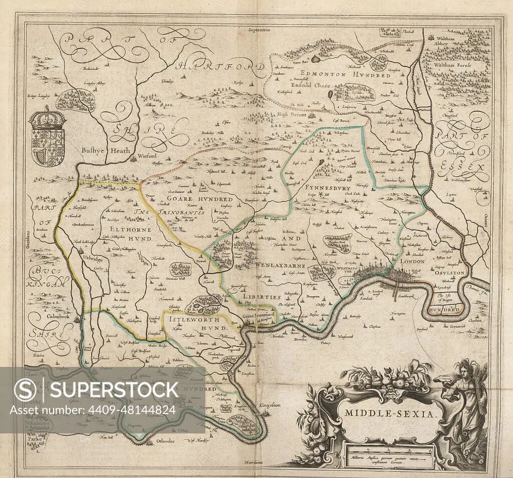
SuperStock offers millions of photos, videos, and stock assets to creatives around the world. This image of Map of the city of London and county of Middlesex, circa 1600. London shown as clutch of churches, surrounded by parishes Kensington, Chelsey, St. Gylles, Lambeth, Southwork, Hampton Court, on the River Thames, Hyde Park and Marybon Park. With title Middle-Sexia in cartouche and coat of arms. Handcoloured copperplate engraving by Johannes Blaeu from Geographiae Volumen Quintum quo Angliae, county atlas of England and Wales, Amsterdam, 1662. by Album/Florilegius/Album Archivo is available for licensing today.
Looking for a license?
Click here, and we'll help you find it! Questions? Just ask!
Click here, and we'll help you find it! Questions? Just ask!
DETAILS
Image Number: 4409-48144824Rights ManagedCredit Line:Album/Florilegius/Album Archivo/SuperStockCollection:Album Archivo Contributor:Album / Florilegius Model Release:NoProperty Release:NoResolution:5081×4740