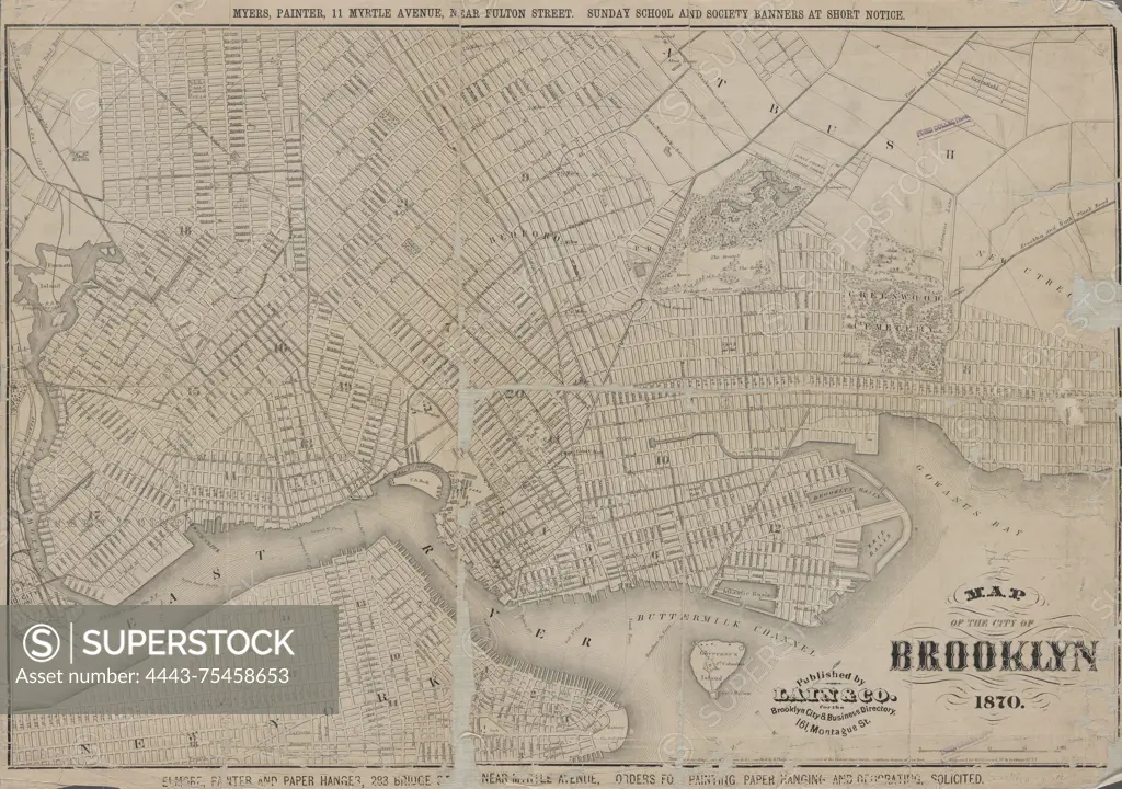
Map of the city of Brooklyn, issued in 1870 by Lain & Co., Brooklyn, New York. The map illustrates distance in 1/2 mile radial zones originating from Brooklyn City Hall. It measures 40 x 59 cm
SuperStock offers millions of photos, videos, and stock assets to creatives around the world. This image of Map of the city of Brooklyn, issued in 1870 by Lain & Co., Brooklyn, New York. The map illustrates distance in 1/2 mile radial zones originating from Brooklyn City Hall. It measures 40 x 59 cm by Artokoloro is available for licensing today.
Looking for a license?
Click here, and we'll help you find it! Questions? Just ask!
Click here, and we'll help you find it! Questions? Just ask!
DETAILS
Image Number: 4443-75458653Rights ManagedCredit Line:Artokoloro/SuperStockCollection:Artokoloro Model Release:NoProperty Release:NoResolution:6701×4716