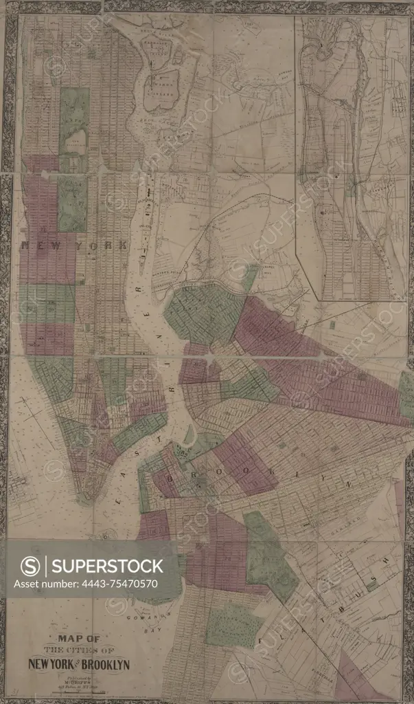
Map of the cities of New York and Brooklyn, 1869, New York, Publisher, M. Dripps, New York (N.Y.), Real property, Landowners, Buildings, Railroads, Piers in New York (State), 1 map col. ; 55 x 167 cm
SuperStock offers millions of photos, videos, and stock assets to creatives around the world. This image of Map of the cities of New York and Brooklyn, 1869, New York, Publisher, M. Dripps, New York (N.Y.), Real property, Landowners, Buildings, Railroads, Piers in New York (State), 1 map col. ; 55 x 167 cm by Artokoloro is available for licensing today.
Looking for a license?
Click here, and we'll help you find it! Questions? Just ask!
Click here, and we'll help you find it! Questions? Just ask!
DETAILS
Image Number: 4443-75470570Rights ManagedCredit Line:Artokoloro/SuperStockCollection:Artokoloro Model Release:NoProperty Release:NoResolution:3357×5700