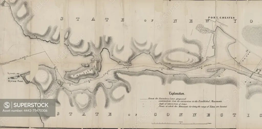
Map of Byram River from its mouth at 'Lyons' or Byram Point to the head of tide water at the ancient wading place, showing the boundary lines proposed by the New York & Connecticut Boundary Commissioners, 1856, to accompany the report of the New York Commissioners to the legislature, 1857. Additional, No. 3., 1857., Albany, N.Y. Publisher, The Commissioners. Rivers of New York (State) and Connecticut, boundaries, and Byram River (N.Y. and Conn.)., 1 map; 40 x 123 cm
SuperStock offers millions of photos, videos, and stock assets to creatives around the world. This image of Map of Byram River from its mouth at 'Lyons' or Byram Point to the head of tide water at the ancient wading place, showing the boundary lines proposed by the New York & Connecticut Boundary Commissioners, 1856, to accompany the report of the New York Commissioners to the legislature, 1857. Additional, No. 3., 1857., Albany, N.Y. Publisher, The Commissioners. Rivers of New York (State) and Connecticut, boundaries, and Byram River (N.Y. and Conn.)., 1 map; 40 x 123 cm by Artokoloro is available for licensing today.
Looking for a license?
Click here, and we'll help you find it! Questions? Just ask!
Click here, and we'll help you find it! Questions? Just ask!
DETAILS
Image Number: 4443-75470306Rights ManagedCredit Line:Artokoloro/SuperStockCollection:Artokoloro Model Release:NoProperty Release:NoResolution:5700×2812