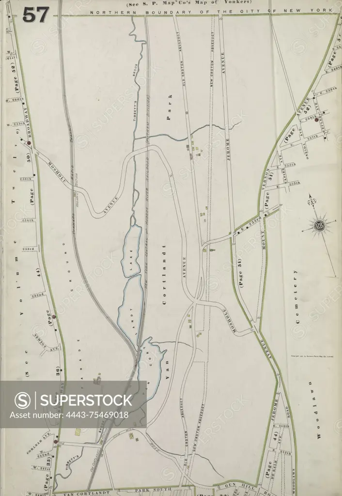
Map of Bronx, Volume 13, Plate No. 57, bounded by Broadway, Van Cortlandt Park South, and Jerome Ave. Issued by the Sanborn Map Company, the map covers the years 1884-1900 and provides a detailed depiction of real property in New York, focusing on cities and towns within the state
SuperStock offers millions of photos, videos, and stock assets to creatives around the world. This image of Map of Bronx, Volume 13, Plate No. 57, bounded by Broadway, Van Cortlandt Park South, and Jerome Ave. Issued by the Sanborn Map Company, the map covers the years 1884-1900 and provides a detailed depiction of real property in New York, focusing on cities and towns within the state by Artokoloro is available for licensing today.
Looking for a license?
Click here, and we'll help you find it! Questions? Just ask!
Click here, and we'll help you find it! Questions? Just ask!
DETAILS
Image Number: 4443-75469018Rights ManagedCredit Line:Artokoloro/SuperStockCollection:Artokoloro Model Release:NoProperty Release:NoResolution:3933×5700