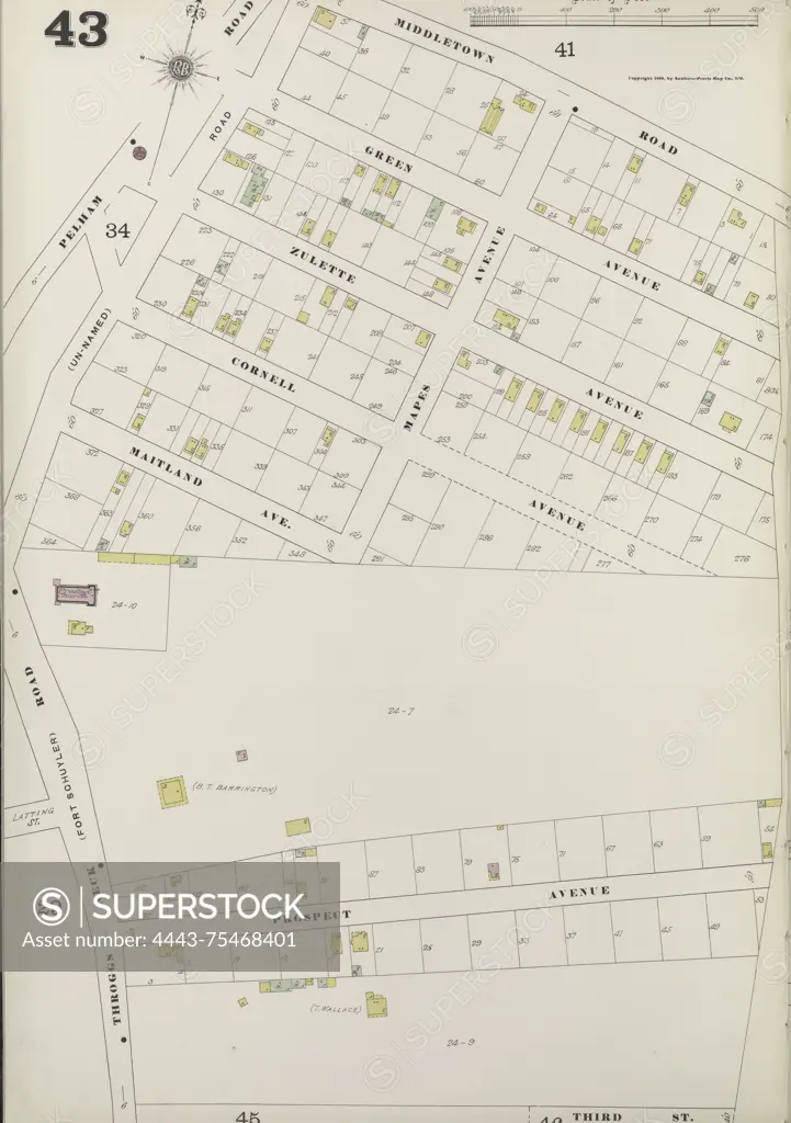
Map of the Bronx, Plate No. 43, bounded by Middletown Rd., 3rd St., and Throggs Neck Rd. Published by the Sanborn Map Company, with issuance dates from 1884 to 1898. The map encompasses fire insurance details and information on real property within the cities and towns of New York State
SuperStock offers millions of photos, videos, and stock assets to creatives around the world. This image of Map of the Bronx, Plate No. 43, bounded by Middletown Rd., 3rd St., and Throggs Neck Rd. Published by the Sanborn Map Company, with issuance dates from 1884 to 1898. The map encompasses fire insurance details and information on real property within the cities and towns of New York State by Artokoloro is available for licensing today.
Looking for a license?
Click here, and we'll help you find it! Questions? Just ask!
Click here, and we'll help you find it! Questions? Just ask!
DETAILS
Image Number: 4443-75468401Rights ManagedCredit Line:Artokoloro/SuperStockCollection:Artokoloro Model Release:NoProperty Release:NoResolution:4016×5700