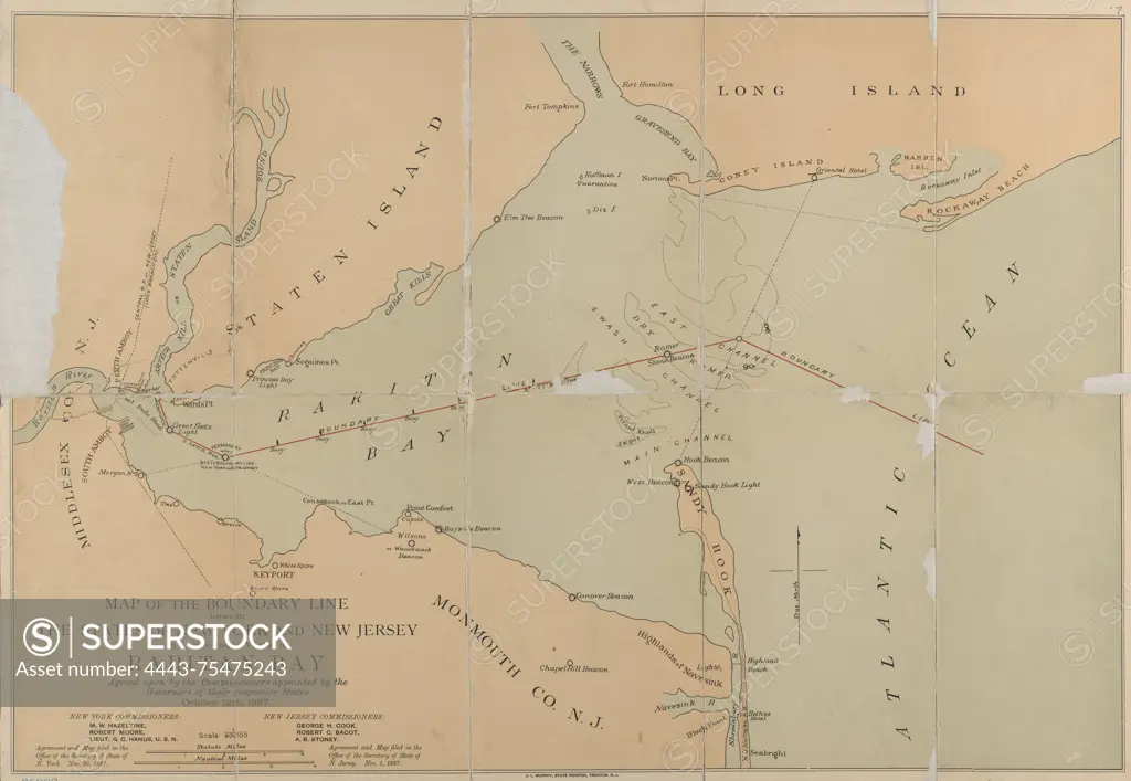
Map of the boundary line between the states of New York and New Jersey in lands under water in Raritan Bay, agreed upon by the commissioners appointed by the governors of their respective states on October 12, 1887., 1887., Trenton, N.J. Publisher, New Jersey Boundary Commission, 1 map, color; dimensions 39 x 57 cm, on sheet 43 x 60 cm
SuperStock offers millions of photos, videos, and stock assets to creatives around the world. This image of Map of the boundary line between the states of New York and New Jersey in lands under water in Raritan Bay, agreed upon by the commissioners appointed by the governors of their respective states on October 12, 1887., 1887., Trenton, N.J. Publisher, New Jersey Boundary Commission, 1 map, color; dimensions 39 x 57 cm, on sheet 43 x 60 cm by Artokoloro is available for licensing today.
Looking for a license?
Click here, and we'll help you find it! Questions? Just ask!
Click here, and we'll help you find it! Questions? Just ask!
DETAILS
Image Number: 4443-75475243Rights ManagedCredit Line:Artokoloro/SuperStockCollection:Artokoloro Model Release:NoProperty Release:NoResolution:5700×3937