Map of Boston for 1888, published by Sampson, Murdock & Co., 1888., 155 Franklin St., Boston., 1 hand-colored map measuring 84 x 68 cm, on a sheet of 86 x 71 cm
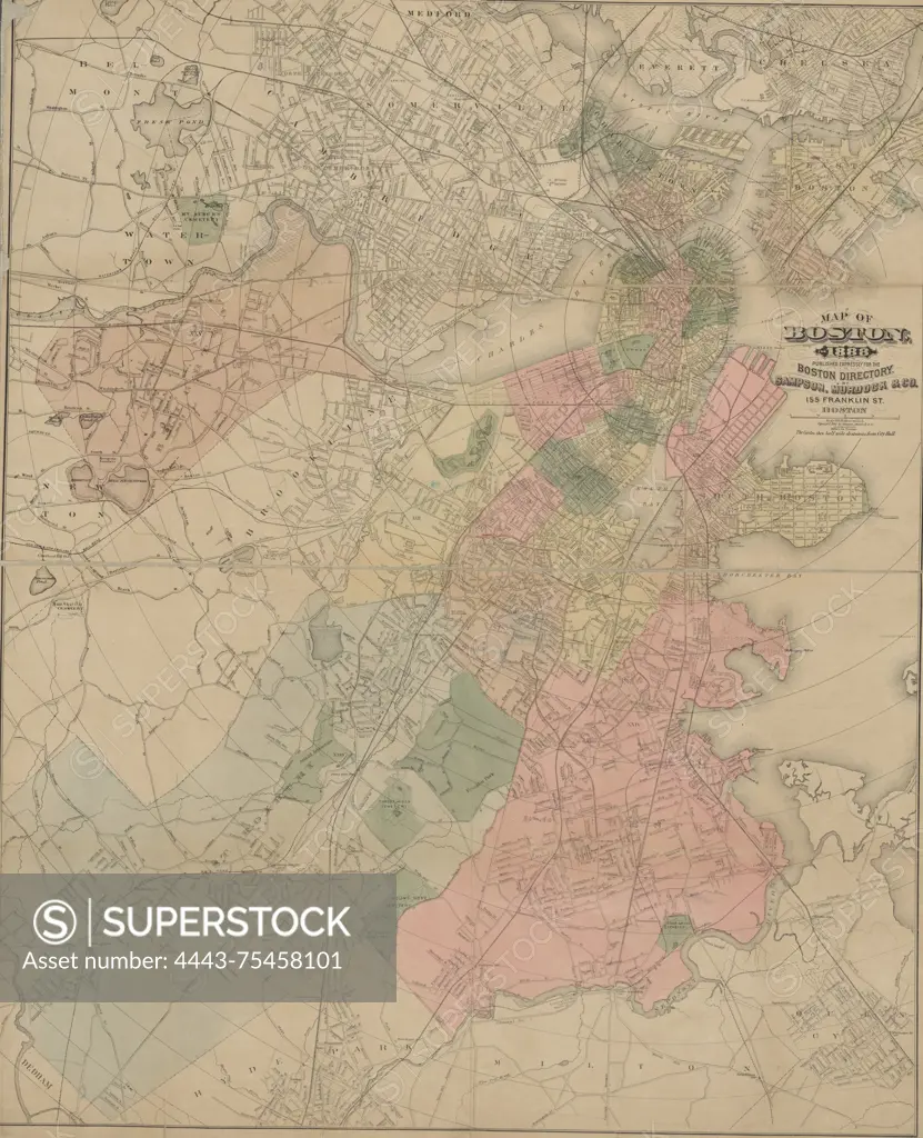
SuperStock offers millions of photos, videos, and stock assets to creatives around the world. This image of Map of Boston for 1888, published by Sampson, Murdock & Co., 1888., 155 Franklin St., Boston., 1 hand-colored map measuring 84 x 68 cm, on a sheet of 86 x 71 cm by Artokoloro is available for licensing today.
Looking for a license?
Click here, and we'll help you find it! Questions? Just ask!
Click here, and we'll help you find it! Questions? Just ask!
DETAILS
Image Number: 4443-75458101Rights ManagedCredit Line:Artokoloro/SuperStockCollection:Artokoloro Story:Historical City MapsModel Release:NoProperty Release:NoResolution:4628×5700