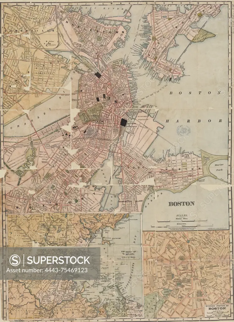
Map of Boston, 1898, published by Rand, McNally & Company. The map includes details on central business districts and street railroads. It measures 65 x 47 cm and is presented in color
SuperStock offers millions of photos, videos, and stock assets to creatives around the world. This image of Map of Boston, 1898, published by Rand, McNally & Company. The map includes details on central business districts and street railroads. It measures 65 x 47 cm and is presented in color by Artokoloro is available for licensing today.
Looking for a license?
Click here, and we'll help you find it! Questions? Just ask!
Click here, and we'll help you find it! Questions? Just ask!
DETAILS
Image Number: 4443-75469123Rights ManagedCredit Line:Artokoloro/SuperStockCollection:Artokoloro Model Release:NoProperty Release:NoResolution:4154×5700