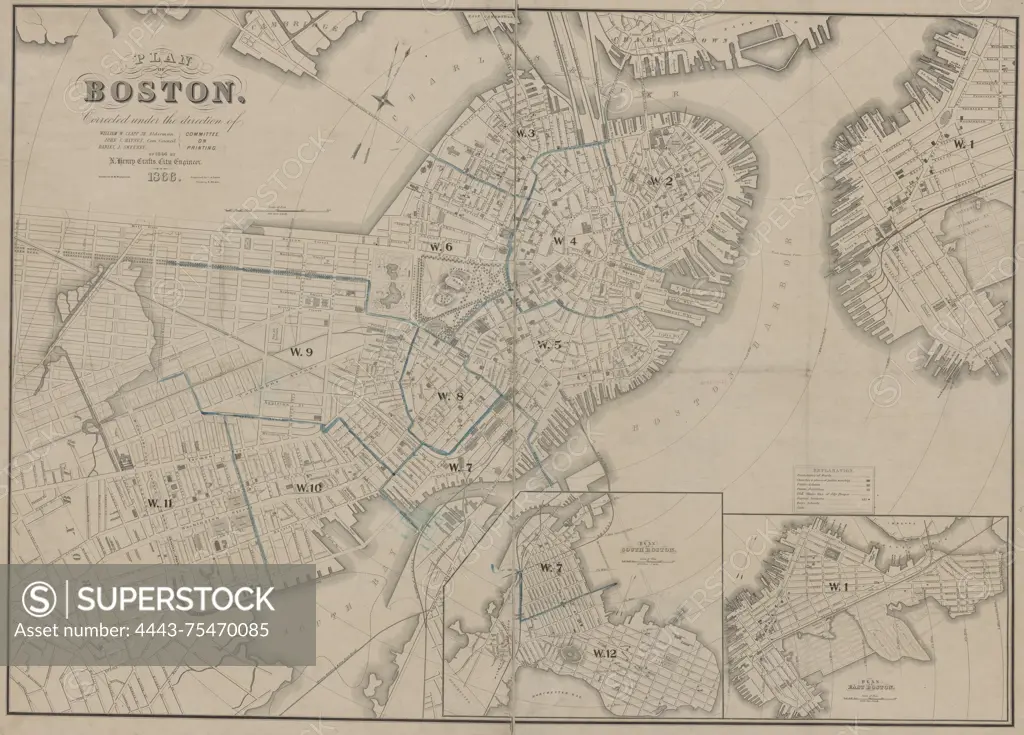
Map of Boston, corrected under the direction of the Committee on Printing of 1864 and 1866. The map is hand-colored and measures 70 x 99 cm, with a sheet size of 78 x 105 cm. It illustrates the administrative and political divisions of Massachusetts, specifically focusing on the city of Boston. Issued in 1866
SuperStock offers millions of photos, videos, and stock assets to creatives around the world. This image of Map of Boston, corrected under the direction of the Committee on Printing of 1864 and 1866. The map is hand-colored and measures 70 x 99 cm, with a sheet size of 78 x 105 cm. It illustrates the administrative and political divisions of Massachusetts, specifically focusing on the city of Boston. Issued in 1866 by Artokoloro is available for licensing today.
Looking for a license?
Click here, and we'll help you find it! Questions? Just ask!
Click here, and we'll help you find it! Questions? Just ask!
DETAILS
Image Number: 4443-75470085Rights ManagedCredit Line:Artokoloro/SuperStockCollection:Artokoloro Model Release:NoProperty Release:NoResolution:5700×4095