Map of Berkeley County, Virginia, issued in 1861 by the U.S. Army Corps of Engineers. The hand-colored map measures 47 x 43 cm. The additional title notes Berkeley County, West Virginia. The map is relevant to the history of the Civil War from 1861 to 1865. The place of publication is inferred to be Washington, D.C
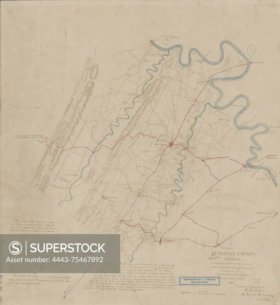
SuperStock offers millions of photos, videos, and stock assets to creatives around the world. This image of Map of Berkeley County, Virginia, issued in 1861 by the U.S. Army Corps of Engineers. The hand-colored map measures 47 x 43 cm. The additional title notes Berkeley County, West Virginia. The map is relevant to the history of the Civil War from 1861 to 1865. The place of publication is inferred to be Washington, D.C by Artokoloro is available for licensing today.
Looking for a license?
Click here, and we'll help you find it! Questions? Just ask!
Click here, and we'll help you find it! Questions? Just ask!
DETAILS
Image Number: 4443-75467892Rights ManagedCredit Line:Artokoloro/SuperStockCollection:Artokoloro Model Release:NoProperty Release:NoResolution:5232×5700