Map of Bedford County, Pennsylvania, issued in 1861 by E.L. Walker, possibly in Pittsburgh. The map is a hand-colored depiction of landowners and real property in Bedford County. It is mounted on cloth backing, measures 102 x 106 cm in total, with individual sheets measuring 59 x 77 cm
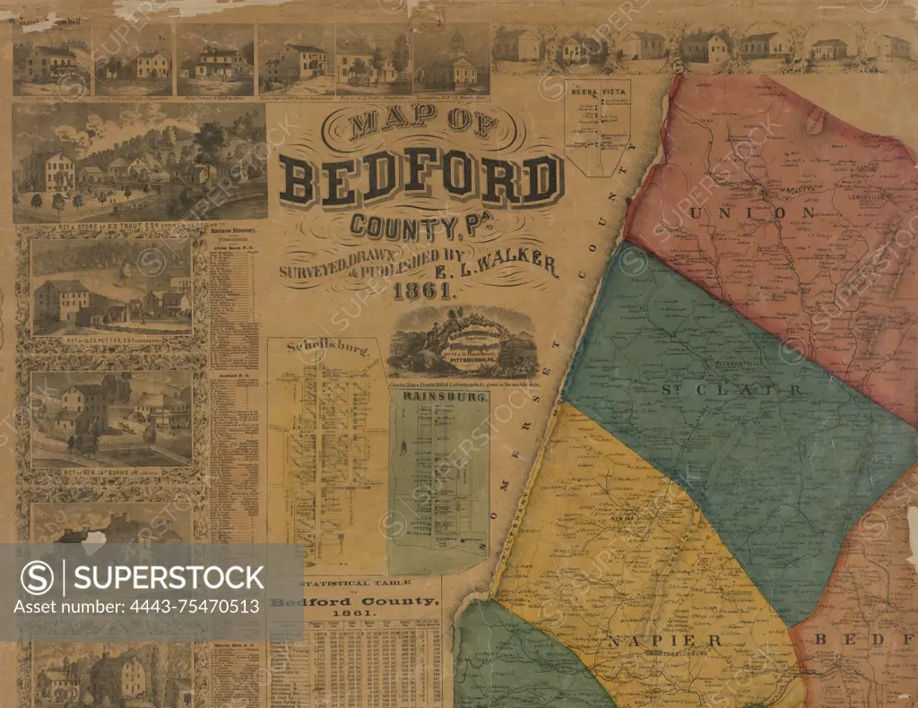
SuperStock offers millions of photos, videos, and stock assets to creatives around the world. This image of Map of Bedford County, Pennsylvania, issued in 1861 by E.L. Walker, possibly in Pittsburgh. The map is a hand-colored depiction of landowners and real property in Bedford County. It is mounted on cloth backing, measures 102 x 106 cm in total, with individual sheets measuring 59 x 77 cm by Artokoloro is available for licensing today.
Looking for a license?
Click here, and we'll help you find it! Questions? Just ask!
Click here, and we'll help you find it! Questions? Just ask!
DETAILS
Image Number: 4443-75470513Rights ManagedCredit Line:Artokoloro/SuperStockCollection:Artokoloro Model Release:NoProperty Release:NoResolution:5700×4401