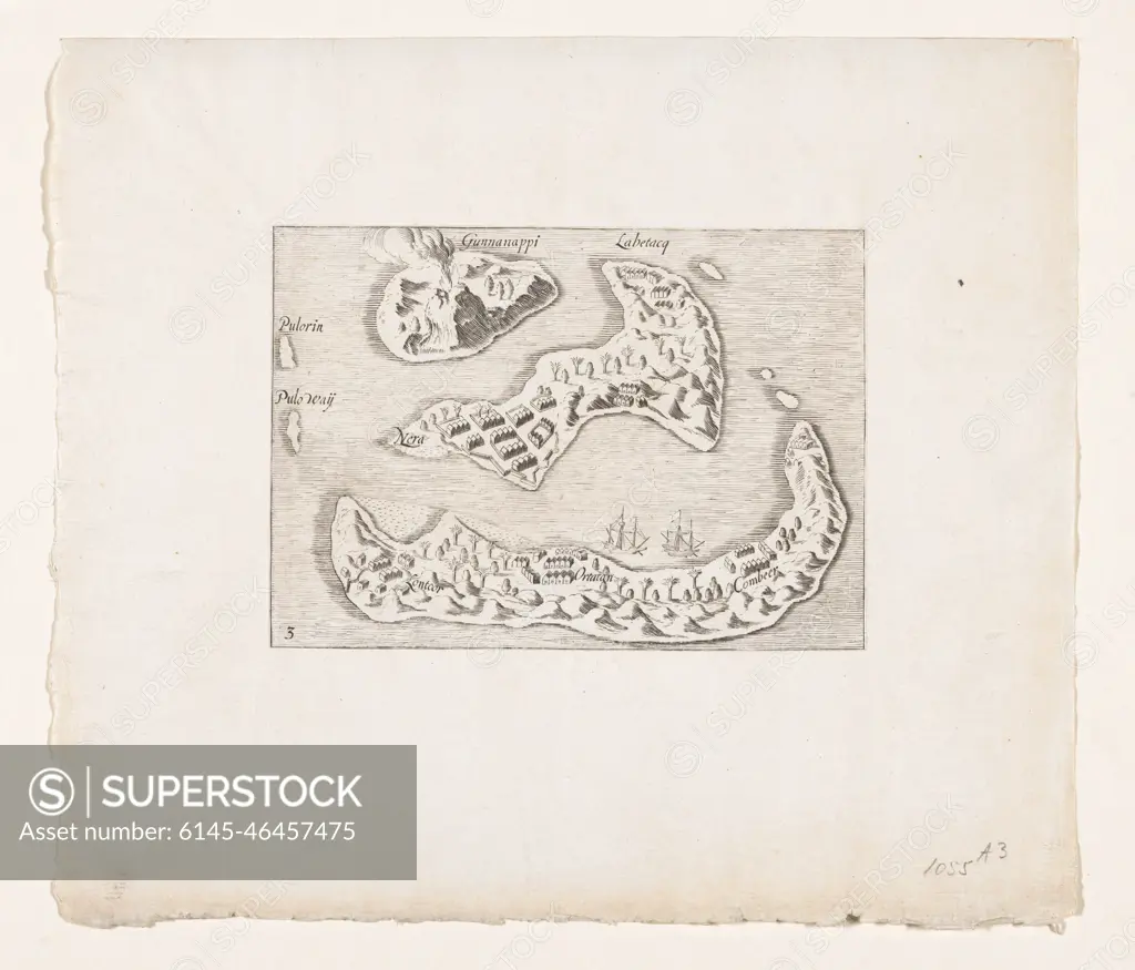
Map of the Banda Islands, 1599. Map of the Banda Islands in the Moluccas, 1599. Main Nutmeg and Foelie supplier. Copy to the original illustration in the travel report of the second Schipvaart to the East Indies under Jacob Cornelisz. Van Nes and Wijbrant Van Warwyck in 1598-1600. Numbered: 3.
SuperStock offers millions of photos, videos, and stock assets to creatives around the world. This image of Map of the Banda Islands, 1599. Map of the Banda Islands in the Moluccas, 1599. Main Nutmeg and Foelie supplier. Copy to the original illustration in the travel report of the second Schipvaart to the East Indies under Jacob Cornelisz. Van Nes and Wijbrant Van Warwyck in 1598-1600. Numbered: 3. by Piemags/PL Photography Limited is available for licensing today.
DETAILS
Image Number: 6145-46457475Royalty FreeCredit Line:Piemags/PL Photography Limited/SuperStockCollection:PL Photography Limited Contributor:Piemags Model Release:NoProperty Release:NoResolution:2500×2137