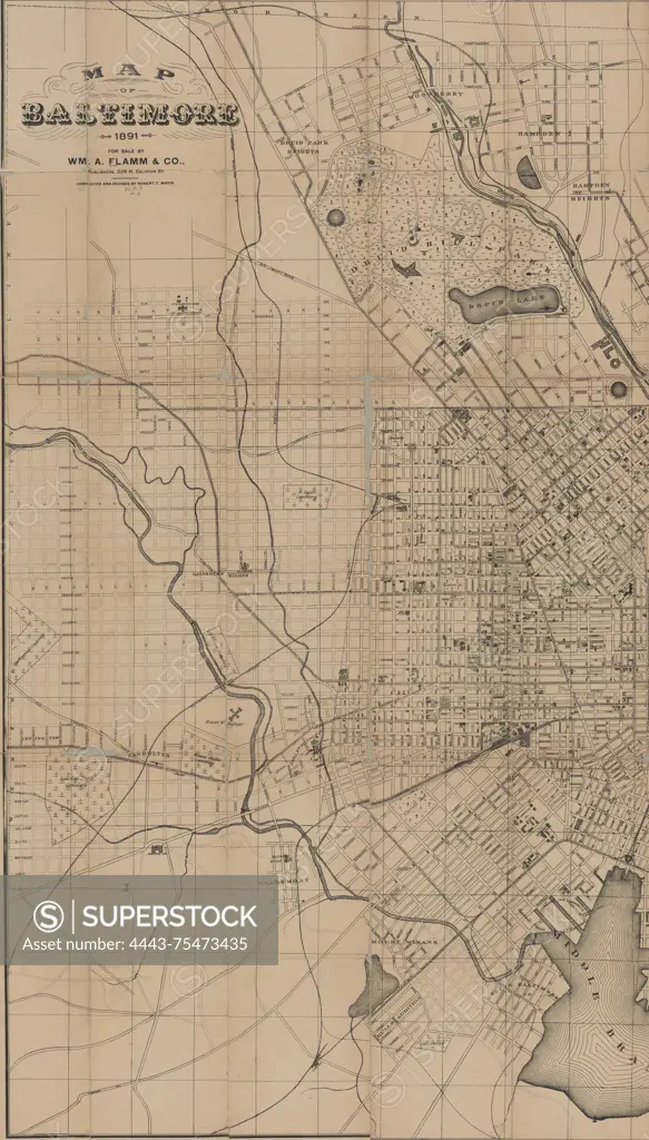
Map of Baltimore, 1891. Additional, New map of City of Baltimore, 1892., 1891 (inferred)., 228 N. Calhoun St. Baltimore. Publisher, WM. A. Flamm & Co. Publishers, Baltimore (Md.)., 1 map; 78 x 91 cm, sheet 81 x 100 cm; divided into 2 sheets of 81 x 50 cm, designed to be folded to 15 x 10 cm
SuperStock offers millions of photos, videos, and stock assets to creatives around the world. This image of Map of Baltimore, 1891. Additional, New map of City of Baltimore, 1892., 1891 (inferred)., 228 N. Calhoun St. Baltimore. Publisher, WM. A. Flamm & Co. Publishers, Baltimore (Md.)., 1 map; 78 x 91 cm, sheet 81 x 100 cm; divided into 2 sheets of 81 x 50 cm, designed to be folded to 15 x 10 cm by Artokoloro is available for licensing today.
Looking for a license?
Click here, and we'll help you find it! Questions? Just ask!
Click here, and we'll help you find it! Questions? Just ask!
DETAILS
Image Number: 4443-75473435Rights ManagedCredit Line:Artokoloro/SuperStockCollection:Artokoloro Model Release:NoProperty Release:NoResolution:3250×5700