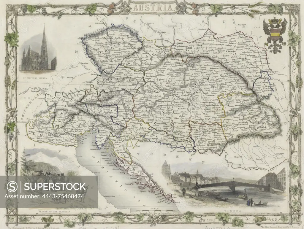
A map of Austria published in 1851 by J. & F. Tallis in London. The map is hand-colored and measures 22 x 30 cm. It features ornamental borders and provides a representation of Austria's geographical layout during that time
SuperStock offers millions of photos, videos, and stock assets to creatives around the world. This image of A map of Austria published in 1851 by J. & F. Tallis in London. The map is hand-colored and measures 22 x 30 cm. It features ornamental borders and provides a representation of Austria's geographical layout during that time by Artokoloro is available for licensing today.
Looking for a license?
Click here, and we'll help you find it! Questions? Just ask!
Click here, and we'll help you find it! Questions? Just ask!
DETAILS
Image Number: 4443-75468474Rights ManagedCredit Line:Artokoloro/SuperStockCollection:Artokoloro Model Release:NoProperty Release:NoResolution:5132×3872