Map of the Atlantic and Gulf Coast Canal and Okeechobee Land Company of Florida, issued in 1881, highlighting the area lands to be improved by canal construction providing an outlet to Lake Okeechobee, encompassing over 8,000,000 acres. Published by Graphic Company in New York. The map dimensions are 64 x 48 cm, mounted on a sheet measuring 70 x 53 cm
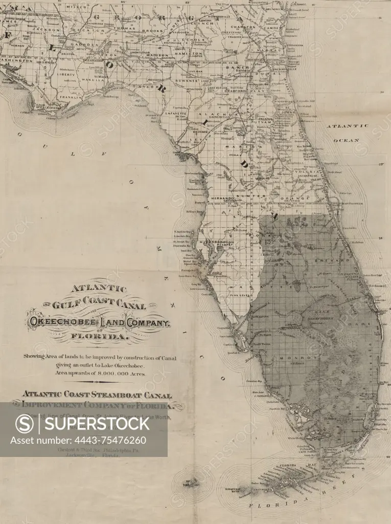
SuperStock offers millions of photos, videos, and stock assets to creatives around the world. This image of Map of the Atlantic and Gulf Coast Canal and Okeechobee Land Company of Florida, issued in 1881, highlighting the area lands to be improved by canal construction providing an outlet to Lake Okeechobee, encompassing over 8,000,000 acres. Published by Graphic Company in New York. The map dimensions are 64 x 48 cm, mounted on a sheet measuring 70 x 53 cm by Artokoloro is available for licensing today.
Looking for a license?
Click here, and we'll help you find it! Questions? Just ask!
Click here, and we'll help you find it! Questions? Just ask!
DETAILS
Image Number: 4443-75476260Rights ManagedCredit Line:Artokoloro/SuperStockCollection:Artokoloro Model Release:NoProperty Release:NoResolution:4262×5700