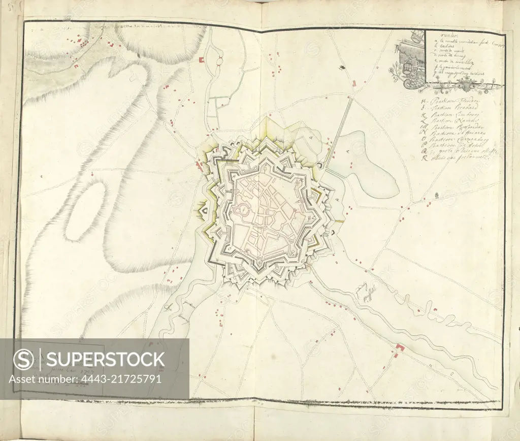
Map of Ath with inundations, 1707, Samuel Du Ry de Champdoré, 1707, Map of the fortifications around the city of Ath, with the inundations in the year 1707. Top right a cartouche with the legend a-R in French and Dutch. Part of a collection of drawn plans of fortified towns in the Netherlands and surrounding countries at the time of the War of the Spanish Succession (part C)., draughtsman: Samuel Du Ry de Champdoré, (mentioned on object), Netherlands, 1707, paper, h 465 mm × w 610 mm
SuperStock offers millions of photos, videos, and stock assets to creatives around the world. This image of Map of Ath with inundations, 1707, Samuel Du Ry de Champdoré, 1707, Map of the fortifications around the city of Ath, with the inundations in the year 1707. Top right a cartouche with the legend a-R in French and Dutch. Part of a collection of drawn plans of fortified towns in the Netherlands and surrounding countries at the time of the War of the Spanish Succession (part C)., draughtsman: Samuel Du Ry de Champdoré, (mentioned on object), Netherlands, 1707, paper, h 465 mm × w 610 mm by Artokoloro is available for licensing today.
Looking for a license?
Click here, and we'll help you find it! Questions? Just ask!
Click here, and we'll help you find it! Questions? Just ask!
DETAILS
Image Number: 4443-21725791Rights ManagedCredit Line:Artokoloro/SuperStockCollection:Artokoloro Model Release:NoProperty Release:NoResolution:4768×4046