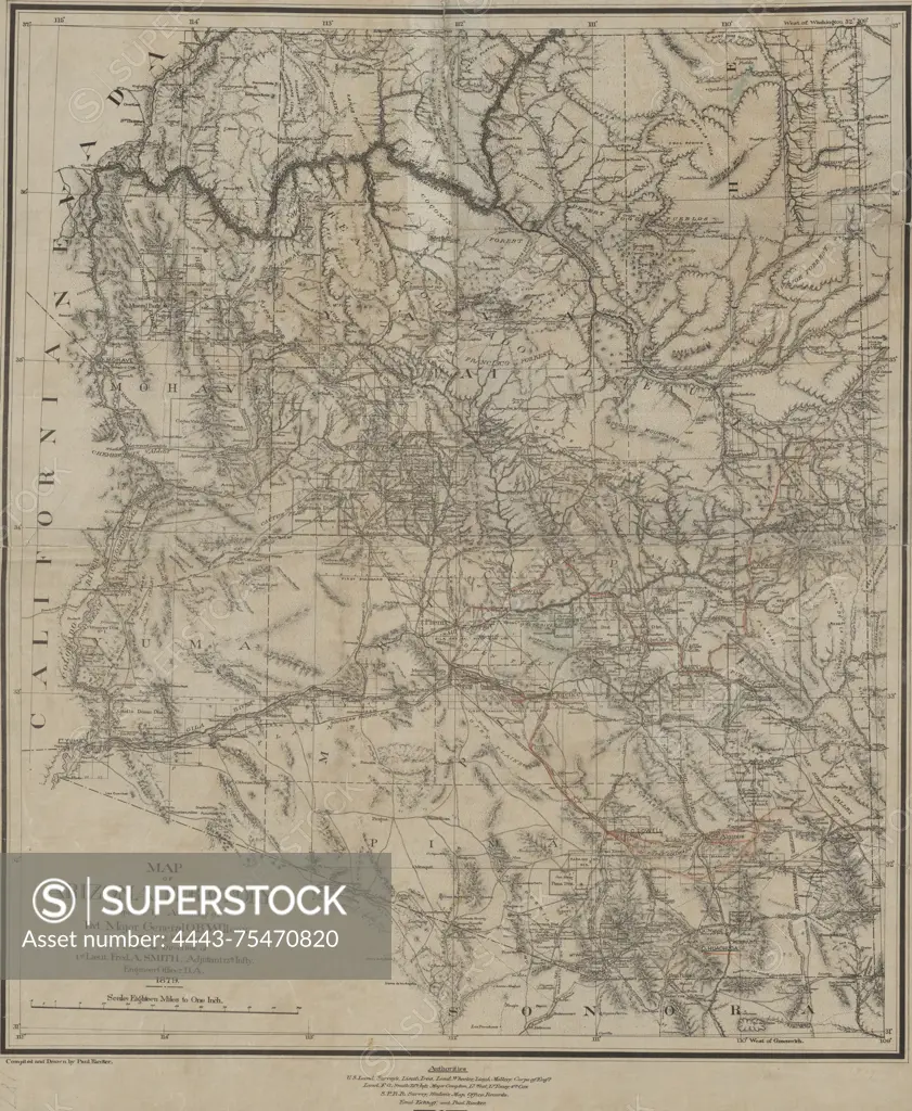
Map of Arizona Territory, 1879. Published by the U.S. Army Corps of Engineers in Washington, D.C. The map measures 59 x 51 cm on a sheet of 67 x 56 cm and includes details related to railroads and the administrative and political divisions of Arizona. The NYPL Map Division copy features a manuscript tracing
SuperStock offers millions of photos, videos, and stock assets to creatives around the world. This image of Map of Arizona Territory, 1879. Published by the U.S. Army Corps of Engineers in Washington, D.C. The map measures 59 x 51 cm on a sheet of 67 x 56 cm and includes details related to railroads and the administrative and political divisions of Arizona. The NYPL Map Division copy features a manuscript tracing by Artokoloro is available for licensing today.
Looking for a license?
Click here, and we'll help you find it! Questions? Just ask!
Click here, and we'll help you find it! Questions? Just ask!
DETAILS
Image Number: 4443-75470820Rights ManagedCredit Line:Artokoloro/SuperStockCollection:Artokoloro Model Release:NoProperty Release:NoResolution:4683×5700