Map of Arizona, issued in 1884 by W.W. Elliott & Co. The map, which measures 44 x 32 cm on a sheet of 47 x 34 cm, features color illustrations, detailing railroads, forest reserves, and administrative and political divisions within Arizona. The NYPL Map Division copy is mounted on muslin, with the verso not completely legible. The publisher's location is noted as 421 Mont. St., San Francisco, California
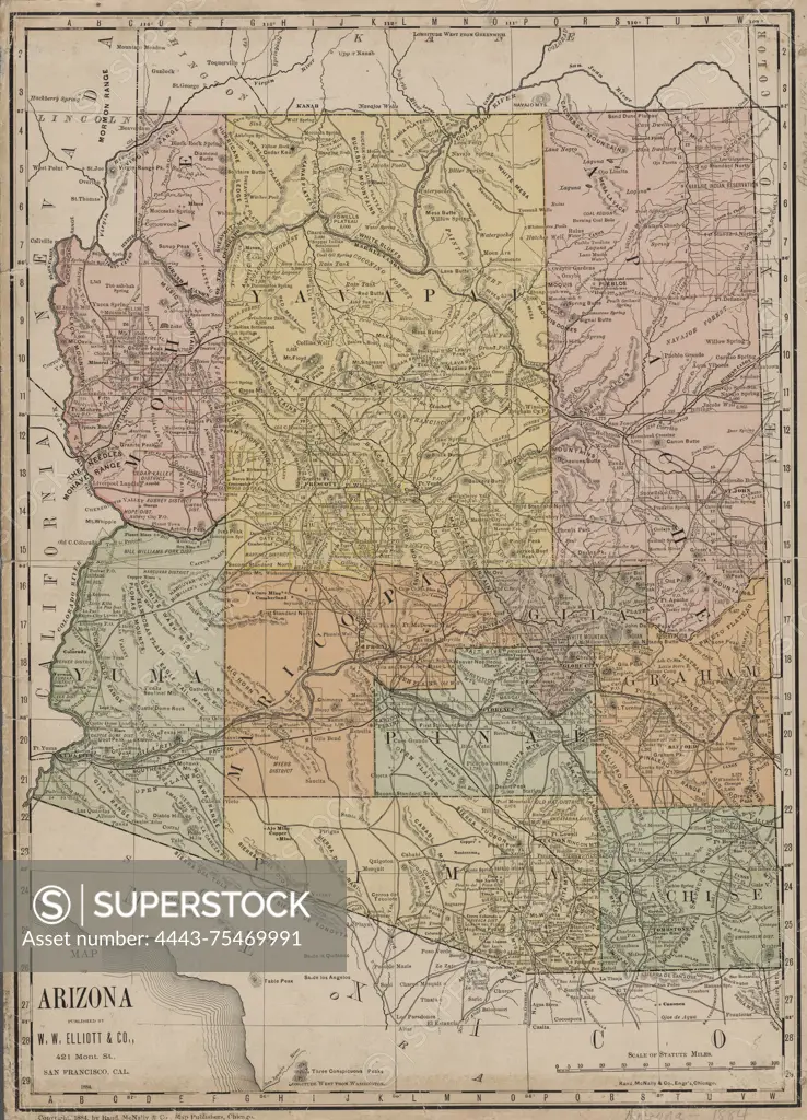
SuperStock offers millions of photos, videos, and stock assets to creatives around the world. This image of Map of Arizona, issued in 1884 by W.W. Elliott & Co. The map, which measures 44 x 32 cm on a sheet of 47 x 34 cm, features color illustrations, detailing railroads, forest reserves, and administrative and political divisions within Arizona. The NYPL Map Division copy is mounted on muslin, with the verso not completely legible. The publisher's location is noted as 421 Mont. St., San Francisco, California by Artokoloro is available for licensing today.
Looking for a license?
Click here, and we'll help you find it! Questions? Just ask!
Click here, and we'll help you find it! Questions? Just ask!
DETAILS
Image Number: 4443-75469991Rights ManagedCredit Line:Artokoloro/SuperStockCollection:Artokoloro Model Release:NoProperty Release:NoResolution:4112×5700