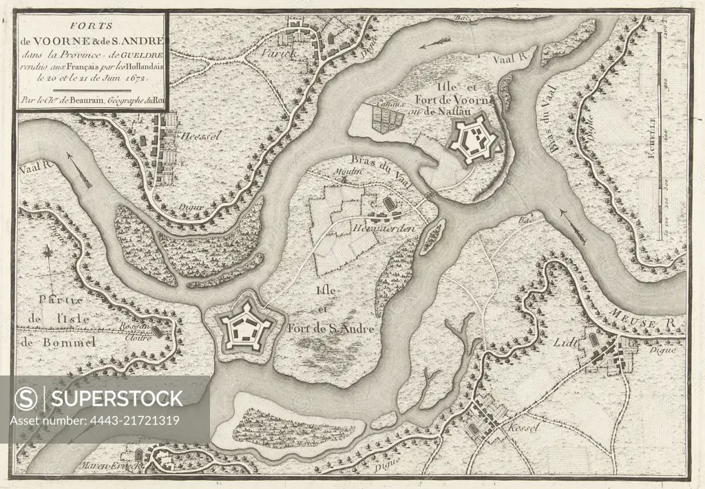
Map of the area around the fort de Voorn and the entrenchment of St Andrew on the Maas, captured by the French army under Marshal de Turenne, 20-21 June 1672, Map of the forts de Voorn and St Andrew on the Maas, captured by the French in 1672 Forts de Voorne & de S Andr, print maker: anonymous, Jean de Beaurain, (mentioned on object), France, 1780 - 1782, paper, etching, h 227 mm × w 325 mm
SuperStock offers millions of photos, videos, and stock assets to creatives around the world. This image of Map of the area around the fort de Voorn and the entrenchment of St Andrew on the Maas, captured by the French army under Marshal de Turenne, 20-21 June 1672, Map of the forts de Voorn and St Andrew on the Maas, captured by the French in 1672 Forts de Voorne & de S Andr, print maker: anonymous, Jean de Beaurain, (mentioned on object), France, 1780 - 1782, paper, etching, h 227 mm × w 325 mm by Artokoloro is available for licensing today.
Looking for a license?
Click here, and we'll help you find it! Questions? Just ask!
Click here, and we'll help you find it! Questions? Just ask!
DETAILS
Image Number: 4443-21721319Rights ManagedCredit Line:Artokoloro/SuperStockCollection:Artokoloro Model Release:NoProperty Release:NoResolution:6254×4344