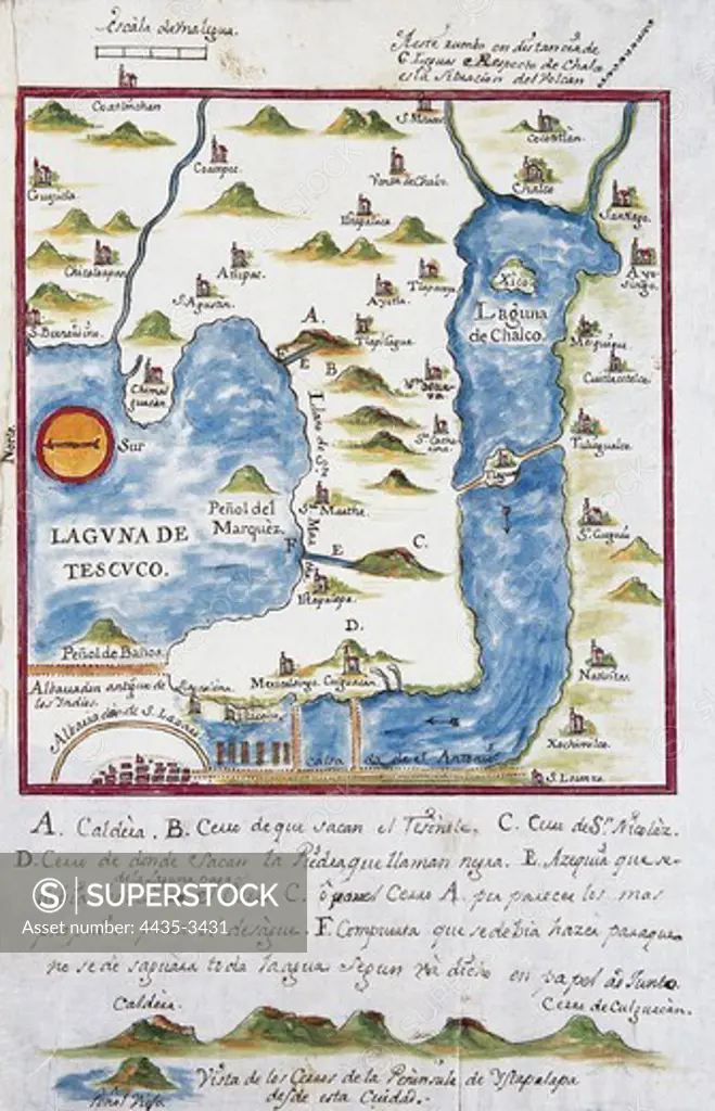
Map of the archbishopric of Mexico (1767), by JosŽ Antonio Alzate. View of the area of Tenochtitlan, the lagoons of Chalco and Tescuco. From the Lorenzana-Borbn Collection. SPAIN. CASTILE-LA MANCHA. Toledo. State Public Library.
SuperStock offers millions of photos, videos, and stock assets to creatives around the world. This image of Map of the archbishopric of Mexico (1767), by JosŽ Antonio Alzate. View of the area of Tenochtitlan, the lagoons of Chalco and Tescuco. From the Lorenzana-Borbn Collection. SPAIN. CASTILE-LA MANCHA. Toledo. State Public Library. by Iberfoto Archivo/Iberfoto is available for licensing today.
Looking for a license?
Click here, and we'll help you find it! Questions? Just ask!
Click here, and we'll help you find it! Questions? Just ask!
DETAILS
Image Number: 4435-3431Rights ManagedCredit Line:Iberfoto Archivo/Iberfoto/SuperStockCollection:Iberfoto Archivo Model Release:NoProperty Release:NoResolution:3486×5416