Map of ancient Syria published in 1900. The boundaries of Syria are shown to include Palestine as far as Gaza, all of Lebanon, and Antakya in Turkey. This corresponds quite closely to Syria before the French Mandate was imposed in 1920. Lebanon was separated from Syria by the French in 1926, and Turkey occupied Antakya unilaterally in 1939.
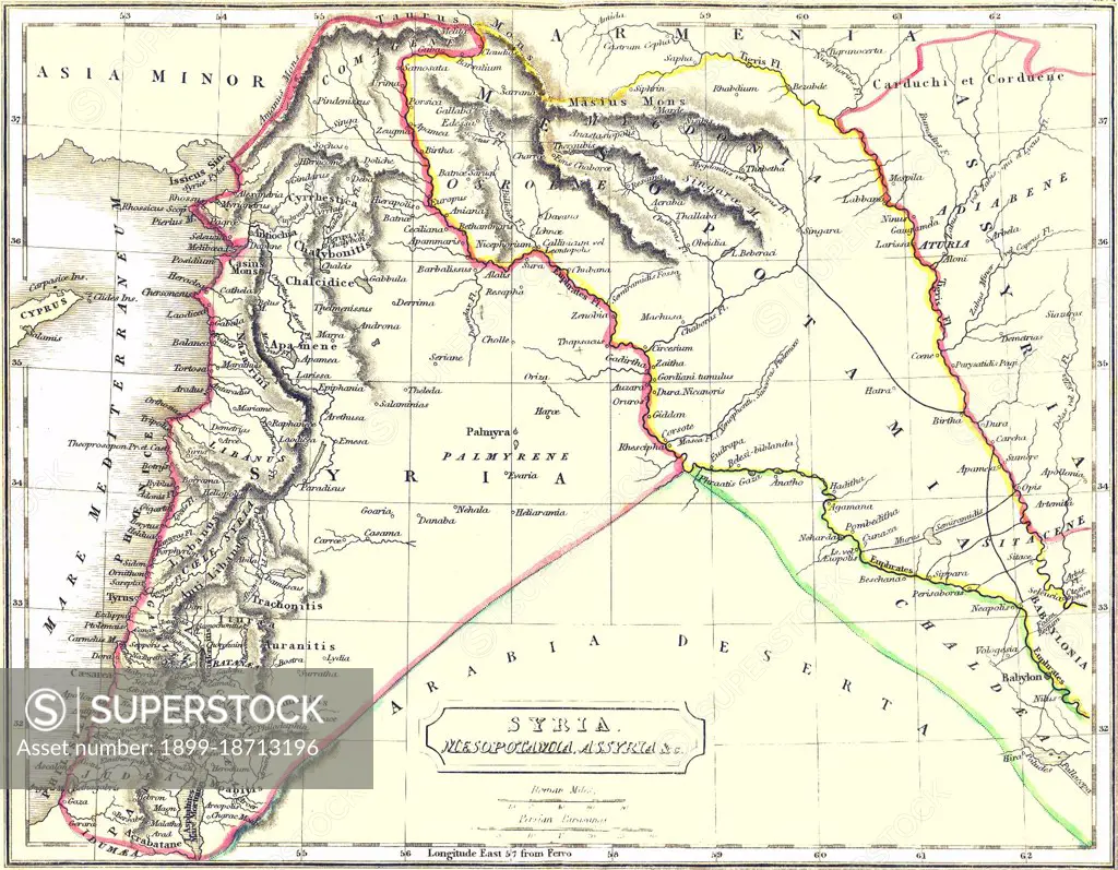
SuperStock offers millions of photos, videos, and stock assets to creatives around the world. This image of Map of ancient Syria published in 1900. The boundaries of Syria are shown to include Palestine as far as Gaza, all of Lebanon, and Antakya in Turkey. This corresponds quite closely to Syria before the French Mandate was imposed in 1920. Lebanon was separated from Syria by the French in 1926, and Turkey occupied Antakya unilaterally in 1939. by Pictures From History/Universal Images is available for licensing today.
Looking for a license?
Click here, and we'll help you find it! Questions? Just ask!
Click here, and we'll help you find it! Questions? Just ask!
DETAILS
Image Number: 1899-18713196Rights ManagedCredit Line:Pictures From History/Universal Images/SuperStockCollection:Universal Images Contributor:Pictures From History Model Release:NoProperty Release:NoResolution:4800×3737