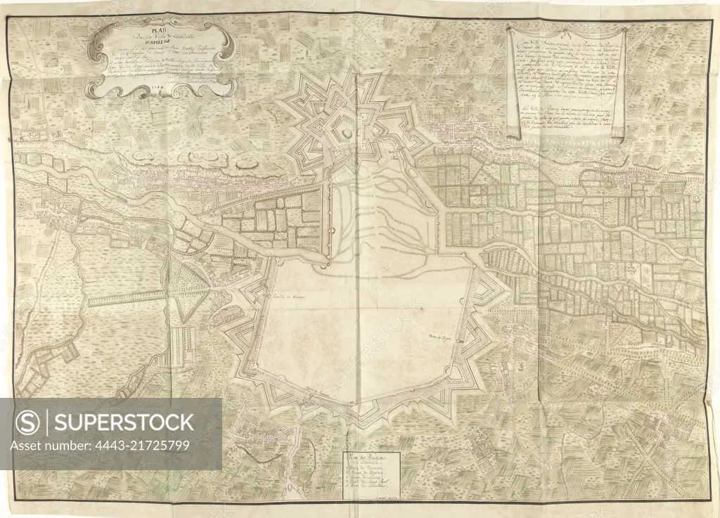
Map of Amiens, 1710, Samuel Du Ry de Champdoré, 1710, Large map of the city of Amiens with its fortifications, 1710. Top left cartouche with the title and dedication, top right drapery with a description, bottom center the names of bastions 1-5 in French. Part of a collection of drawn plans of fortified places in the Netherlands and surrounding countries at the time of the War of the Spanish Succession (Part C)., draughtsman: Samuel Du Ry de Champdoré, (mentioned on object), Johannes van den Bergh, (mentioned on object), Samuel Du Ry de Champdoré, (mentioned on object), Netherlands, 1710, paper, h 826 mm × w 1145 mm
SuperStock offers millions of photos, videos, and stock assets to creatives around the world. This image of Map of Amiens, 1710, Samuel Du Ry de Champdoré, 1710, Large map of the city of Amiens with its fortifications, 1710. Top left cartouche with the title and dedication, top right drapery with a description, bottom center the names of bastions 1-5 in French. Part of a collection of drawn plans of fortified places in the Netherlands and surrounding countries at the time of the War of the Spanish Succession (Part C)., draughtsman: Samuel Du Ry de Champdoré, (mentioned on object), Johannes van den Bergh, (mentioned on object), Samuel Du Ry de Champdoré, (mentioned on object), Netherlands, 1710, paper, h 826 mm × w 1145 mm by Artokoloro is available for licensing today.
Looking for a license?
Click here, and we'll help you find it! Questions? Just ask!
Click here, and we'll help you find it! Questions? Just ask!
DETAILS
Image Number: 4443-21725799Rights ManagedCredit Line:Artokoloro/SuperStockCollection:Artokoloro Model Release:NoProperty Release:NoResolution:6294×4536