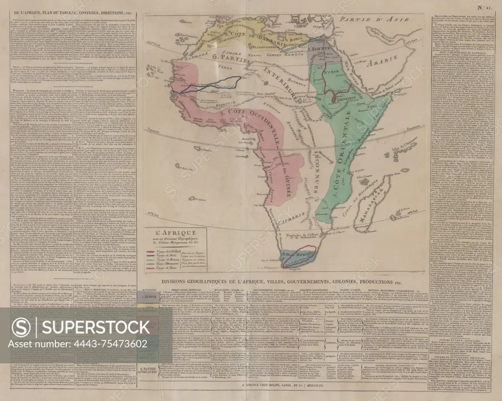
A map of Africa showcasing its geographical divisions and European colonies, created in 1806. It measures 38 x 35 cm with a total size of 63 x 50 cm, published in Florence by Molini, Landi et c.e
SuperStock offers millions of photos, videos, and stock assets to creatives around the world. This image of A map of Africa showcasing its geographical divisions and European colonies, created in 1806. It measures 38 x 35 cm with a total size of 63 x 50 cm, published in Florence by Molini, Landi et c.e by Artokoloro is available for licensing today.
Looking for a license?
Click here, and we'll help you find it! Questions? Just ask!
Click here, and we'll help you find it! Questions? Just ask!
DETAILS
Image Number: 4443-75473602Rights ManagedCredit Line:Artokoloro/SuperStockCollection:Artokoloro Model Release:NoProperty Release:NoResolution:5700×4560