1775 Mannevillette Map of Southern India and Ceylon or Sri Lanka

1775 Mannevillette Map of Southern India and Ceylon or Sri Lanka
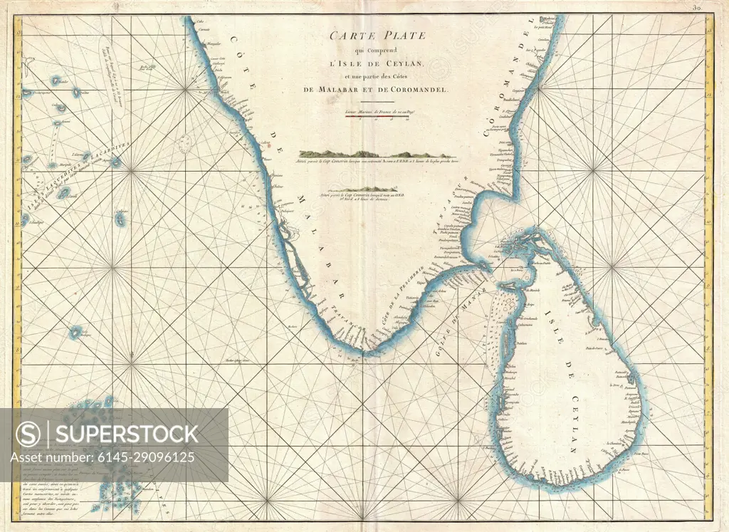
SuperStock offers millions of photos, videos, and stock assets to creatives around the world. This image of Vintage Maritime Map of Ceylon: Explore Historical Maritime Routes and Cartography of Sri Lanka with This Antique Navigation Chart. by Piemags/PL Photography Limited is available for licensing today.
Royalty Free License
Royalty-Free Standard Commercial licenses are granted for worldwide, non-exclusive and perpetual use, unless specifically noted otherwise. All Royalty-Free transactions are final. The Royalty-Free Standard Commercial license has no limitations and covers up to 15 users.
  • $50.00 Low500 X 365
  • $150.00 Med750 X 547
  • $250.00 High5000 X 3649
  • Download your images from the download tab on this page after purchase.
  • Up to 5 downloads
  • Can be used for a year after purchase.
$1,225.00
RF High / Super Res 5 Pack
Save $25.00
$245.00
per download
Order a Framed Print
DETAILS
Image Number:  6145-29096125Royalty FreeCredit Line:Piemags/PL Photography Limited/SuperStockCollection:Contributor:Model Release:NoProperty Release:NoResolution:5000×3649
|
|
|
|
|
|
|