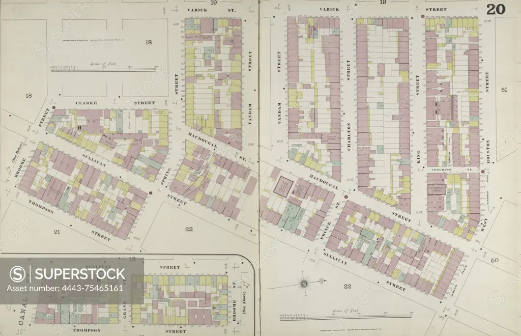
Manhattan, V. 1, Double Page Plate No. 20 Map bounded by Varick St., Houston St., Sullivan St., Thompson St., Broomr St., Clarke St., 1884-1894, Sanborn Map Company., 1884, New York, Publisher, Sanborn Map Company, 1894. Fire insurance map of New York (State) focusing on real property, cities, and towns
SuperStock offers millions of photos, videos, and stock assets to creatives around the world. This image of Manhattan, V. 1, Double Page Plate No. 20 Map bounded by Varick St., Houston St., Sullivan St., Thompson St., Broomr St., Clarke St., 1884-1894, Sanborn Map Company., 1884, New York, Publisher, Sanborn Map Company, 1894. Fire insurance map of New York (State) focusing on real property, cities, and towns by Artokoloro is available for licensing today.
Looking for a license?
Click here, and we'll help you find it! Questions? Just ask!
Click here, and we'll help you find it! Questions? Just ask!
DETAILS
Image Number: 4443-75465161Rights ManagedCredit Line:Artokoloro/SuperStockCollection:Artokoloro Model Release:NoProperty Release:NoResolution:6777×4368