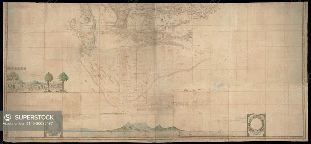
Lower (southern) half of Gordon's great map of Southern Africa.Card in two halves. This part covers the area, limited in the north by the 32º ZB line; Furthermore, by a line walking from the northeast from 32º ZB to the west coast via Saldan bay at 32º ZB; The sea is only described south of the coast from Houtbaai to the mouth of the Sondags river. Also contains various images of residents and animals; Text accelerated by means of a guide map with degree indications.
SuperStock offers millions of photos, videos, and stock assets to creatives around the world. This image of Lower (southern) half of Gordon's great map of Southern Africa.Card in two halves. This part covers the area, limited in the north by the 32º ZB line; Furthermore, by a line walking from the northeast from 32º ZB to the west coast via Saldan bay at 32º ZB; The sea is only described south of the coast from Houtbaai to the mouth of the Sondags river. Also contains various images of residents and animals; Text accelerated by means of a guide map with degree indications. by Piemags/PL Photography Limited is available for licensing today.
Looking for a license?
Click here, and we'll help you find it! Questions? Just ask!
Click here, and we'll help you find it! Questions? Just ask!
DETAILS
Image Number: 6145-30085497Royalty FreeCredit Line:Piemags/PL Photography Limited/SuperStockCollection:PL Photography Limited Contributor:Piemags Model Release:NoProperty Release:NoResolution:2500×1158