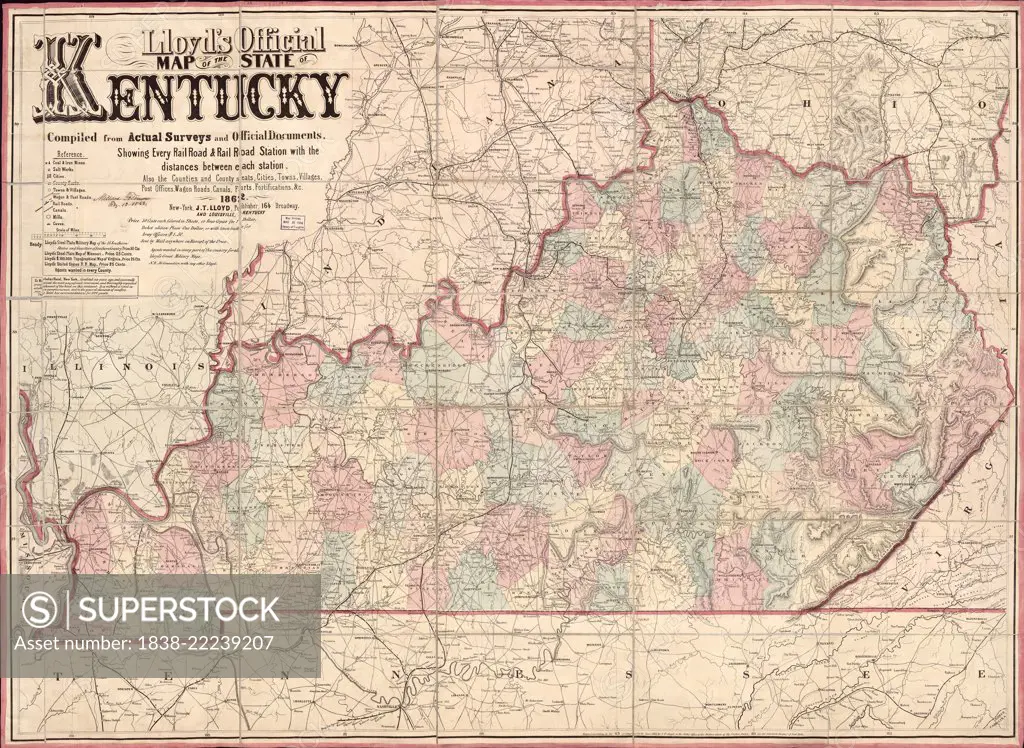
Lloyd's official map of the State of Kentucky, Published by James T. Lloyd, New York, 1862
SuperStock offers millions of photos, videos, and stock assets to creatives around the world. This image of Lloyd's official map of the State of Kentucky, Published by James T. Lloyd, New York, 1862 by Circa Images/Glasshouse Images is available for licensing today.
Looking for a license?
Click here, and we'll help you find it! Questions? Just ask!
Click here, and we'll help you find it! Questions? Just ask!
DETAILS
Image Number: 1838-22239207Rights ManagedCredit Line:Circa Images/Glasshouse Images/SuperStockCollection:Glasshouse Images Contributor:Circa Images Model Release:NoProperty Release:NoResolution:4924×3600