Lloyd's new county map of the United States and Canada, showing battlefields and railroads, compiled from the latest government surveys and other reliable sources. Issued in 1863 by H.H. Lloyd & Co., this hand-colored map measures 94 x 129 cm and represents important geographical and historical information from the American Civil War era (1861-1865), including regions in Ontario and Québec
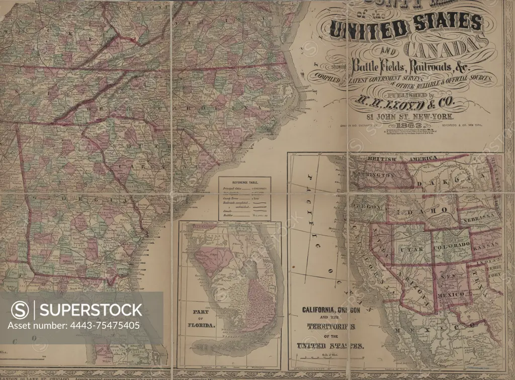
SuperStock offers millions of photos, videos, and stock assets to creatives around the world. This image of Lloyd's new county map of the United States and Canada, showing battlefields and railroads, compiled from the latest government surveys and other reliable sources. Issued in 1863 by H.H. Lloyd & Co., this hand-colored map measures 94 x 129 cm and represents important geographical and historical information from the American Civil War era (1861-1865), including regions in Ontario and Québec by Artokoloro is available for licensing today.
Looking for a license?
Click here, and we'll help you find it! Questions? Just ask!
Click here, and we'll help you find it! Questions? Just ask!
DETAILS
Image Number: 4443-75475405Rights ManagedCredit Line:Artokoloro/SuperStockCollection:Artokoloro Model Release:NoProperty Release:NoResolution:5700×4216