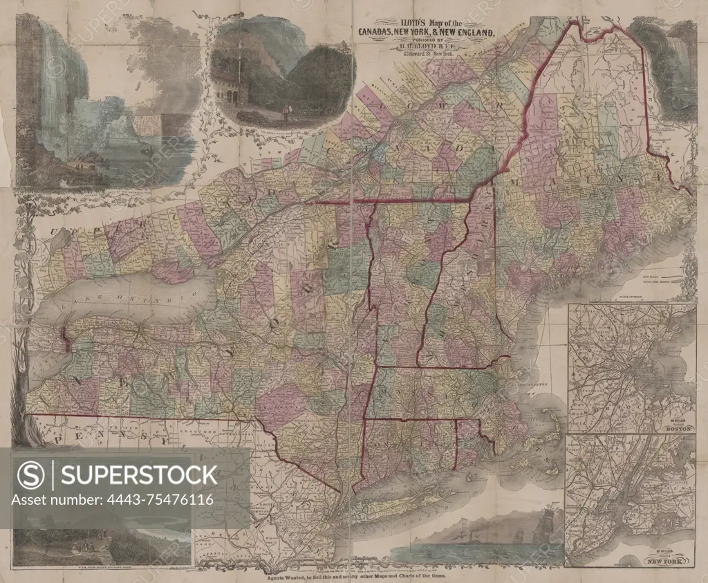
Lloyd's map of the Canadas, New York, & New England, 1855, H.H. Lloyd & Co. Additional, Tourist's map of New York, New England, and Canada., 1855., 25 Howard St., New York. Publisher, H.H. Lloyd & Co., New York., 1 hand-colored map; 57 x 69 cm, on sheet 61 x 75 cm
SuperStock offers millions of photos, videos, and stock assets to creatives around the world. This image of Lloyd's map of the Canadas, New York, & New England, 1855, H.H. Lloyd & Co. Additional, Tourist's map of New York, New England, and Canada., 1855., 25 Howard St., New York. Publisher, H.H. Lloyd & Co., New York., 1 hand-colored map; 57 x 69 cm, on sheet 61 x 75 cm by Artokoloro is available for licensing today.
Looking for a license?
Click here, and we'll help you find it! Questions? Just ask!
Click here, and we'll help you find it! Questions? Just ask!
DETAILS
Image Number: 4443-75476116Rights ManagedCredit Line:Artokoloro/SuperStockCollection:Artokoloro Model Release:NoProperty Release:NoResolution:5700×4696