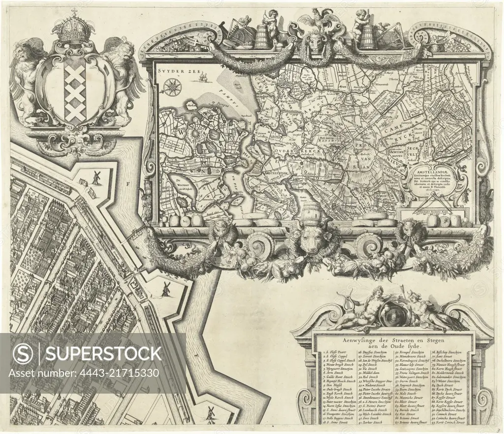
Large map of the city of Amsterdam from 1625. Top left a view of the city and top right a map of the surrounding area. On the right, a list of names of streets on the Old and New City sides. The map is composed of nine sheets, two of which are missing. This is the top right sheet with the map of the environs of Amsterdam: Amstelland, Map of Amsterdam (top right sheet), 1625, print maker: Balthasar Florisz. van Berckenrode, Balthasar Florisz. van Berckenrode, publisher: Philippus Molevliet, Amsterdam, 1625, paper, etching, h 458 mm × w 532 mm
SuperStock offers millions of photos, videos, and stock assets to creatives around the world. This image of Large map of the city of Amsterdam from 1625. Top left a view of the city and top right a map of the surrounding area. On the right, a list of names of streets on the Old and New City sides. The map is composed of nine sheets, two of which are missing. This is the top right sheet with the map of the environs of Amsterdam: Amstelland, Map of Amsterdam (top right sheet), 1625, print maker: Balthasar Florisz. van Berckenrode, Balthasar Florisz. van Berckenrode, publisher: Philippus Molevliet, Amsterdam, 1625, paper, etching, h 458 mm × w 532 mm by Artokoloro is available for licensing today.
Looking for a license?
Click here, and we'll help you find it! Questions? Just ask!
Click here, and we'll help you find it! Questions? Just ask!
DETAILS
Image Number: 4443-21715330Rights ManagedCredit Line:Artokoloro/SuperStockCollection:Artokoloro Model Release:NoProperty Release:NoResolution:5292×4558