Labor commissioner's official map of Missouri showing by counties the commodities marketed by rail, river, and express during the year 1891-1892. Additional, Official map of Missouri., 1892., St. Louis, Mo. Publisher, publisher not identified. Farm produce, Missouri, Statistics, Administrative and political divisions., 1 map color; on sheet 80 x 91 cm
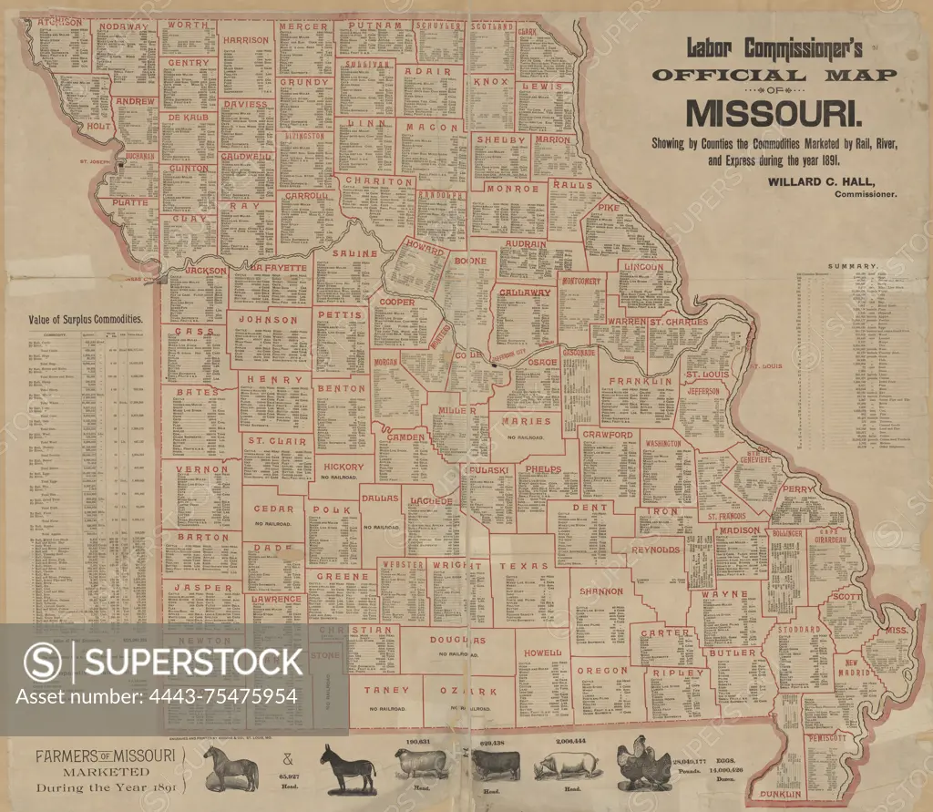
SuperStock offers millions of photos, videos, and stock assets to creatives around the world. This image of Labor commissioner's official map of Missouri showing by counties the commodities marketed by rail, river, and express during the year 1891-1892. Additional, Official map of Missouri., 1892., St. Louis, Mo. Publisher, publisher not identified. Farm produce, Missouri, Statistics, Administrative and political divisions., 1 map color; on sheet 80 x 91 cm by Artokoloro is available for licensing today.
Looking for a license?
Click here, and we'll help you find it! Questions? Just ask!
Click here, and we'll help you find it! Questions? Just ask!
DETAILS
Image Number: 4443-75475954Rights ManagedCredit Line:Artokoloro/SuperStockCollection:Artokoloro Model Release:NoProperty Release:NoResolution:5700×4961