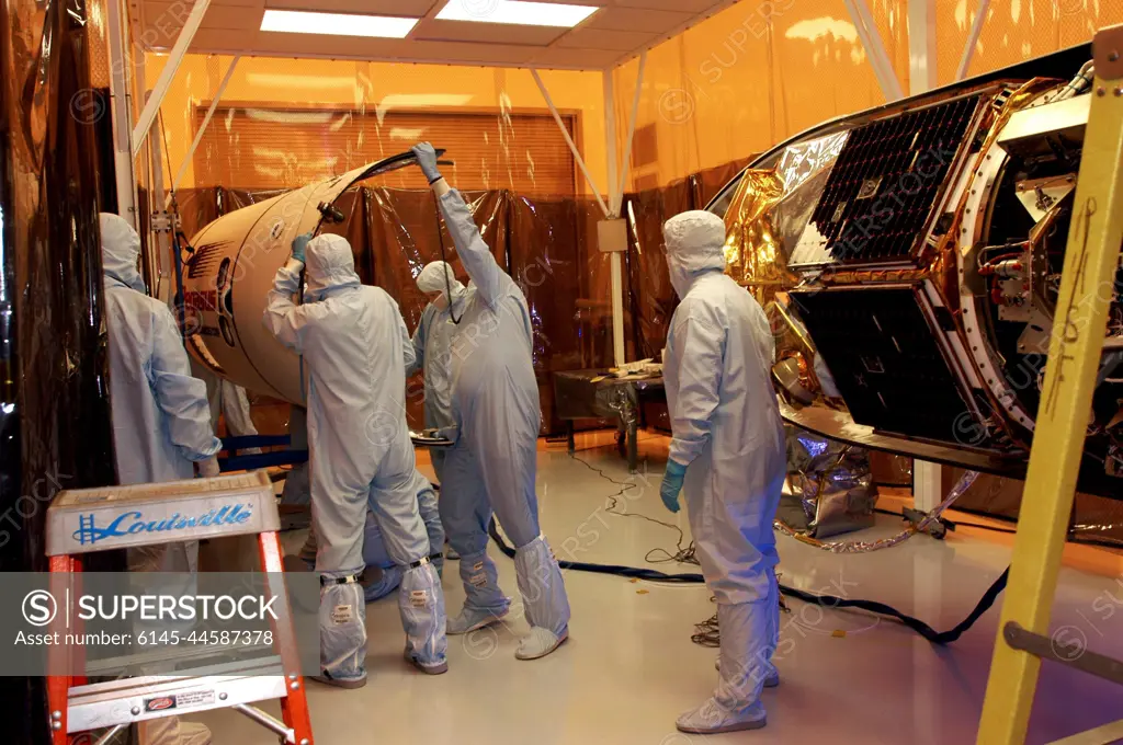
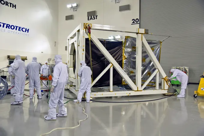
KENNEDY SPACE CENTER, FLA. -- Workers in the Multi-Purpose Processing Facility move part of the fairing toward the Solar Radiation and Climate Experiment (SORCE) satellite for encapsulation. The satellite will be installed in the Pegasus XL launch vehicle. Built by Orbital Sciences Corporation (OSC), SORCE will study and measure solar irradiance as a source of energy in the Earth's atmosphere. The launch of SORCE is scheduled for Jan. 25 at 3:14 p.m. from Cape Canaveral Air Force Station, Fla. The drop of the Pegasus will be from OSC's L-1011 aircraft at an altitude of 39,000 feet over the Atlantic Ocean approximately 100 miles east-southeast of Cape Canaveral.
SuperStock offers millions of photos, videos, and stock assets to creatives around the world. This image of KENNEDY SPACE CENTER, FLA. -- Workers in the Multi-Purpose Processing Facility move part of the fairing toward the Solar Radiation and Climate Experiment (SORCE) satellite for encapsulation. The satellite will be installed in the Pegasus XL launch vehicle. Built by Orbital Sciences Corporation (OSC), SORCE will study and measure solar irradiance as a source of energy in the Earth's atmosphere. The launch of SORCE is scheduled for Jan. 25 at 3:14 p.m. from Cape Canaveral Air Force Station, Fla. The drop of the Pegasus will be from OSC's L-1011 aircraft at an altitude of 39,000 feet over the Atlantic Ocean approximately 100 miles east-southeast of Cape Canaveral. by Piemags/PL Photography Limited is available for licensing today.
Visually Similar More from NASA Spacecraft Engineering story


Looking for a license?
Click here, and we'll help you find it! Questions? Just ask!
Click here, and we'll help you find it! Questions? Just ask!
DETAILS
Image Number: 6145-44587378Royalty FreeCredit Line:Piemags/PL Photography Limited/SuperStockCollection:PL Photography Limited Story:NASA Spacecraft EngineeringContributor:Piemags Model Release:NoProperty Release:NoResolution:3000×1993