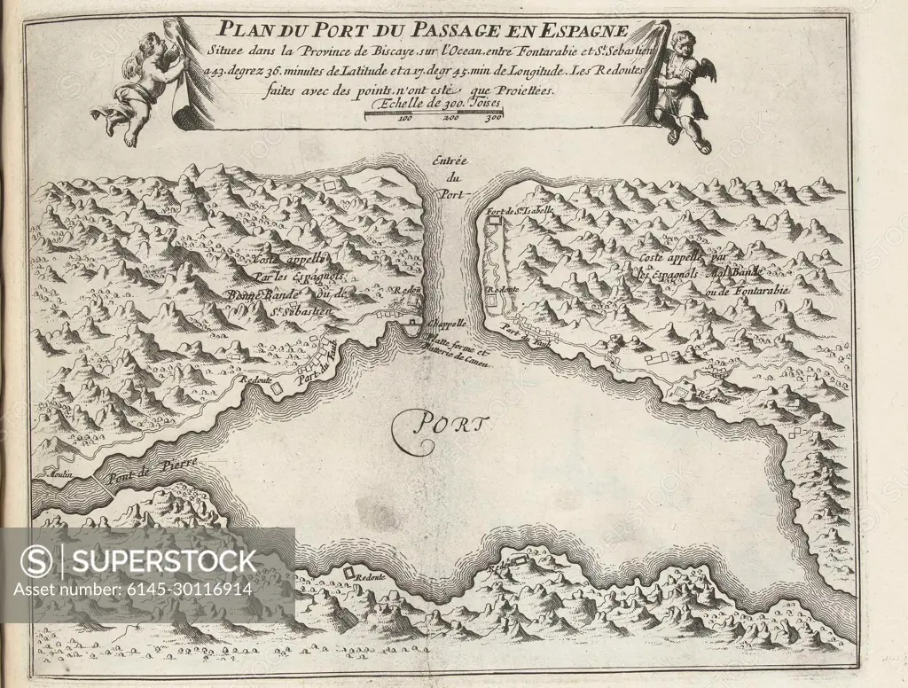
Kaart van of Naturlijke Haven Van Puerto de Pasajes, ca. 1693-1696; Plan of the port of the passage in Spain (...); The forces of Europe, or description of the main cities, with their fortifications: designed by the best ingenieurs, particularly those (...) of France, whose plans have been lifted by M. de Vauban.map of the Natural Harbor of Puerto de Pasajes to the Spanish North Coast at San Sebastian, ca. 1693-1696. Part of the Sixth Part (1696) of the Picture in Which Bundles Are The Eight Parts of the Forces of Europe Issued Between 1693-1697. The Printing Works Consistencuts of 175 Flat Plans (from Sebastien Le Preterre, Lord of Vauban) from Renownedred Strong Cities and Fortresses in the Nine-Year War. Title and registrations in French.
SuperStock offers millions of photos, videos, and stock assets to creatives around the world. This image of Kaart van of Naturlijke Haven Van Puerto de Pasajes, ca. 1693-1696; Plan of the port of the passage in Spain (...); The forces of Europe, or description of the main cities, with their fortifications: designed by the best ingenieurs, particularly those (...) of France, whose plans have been lifted by M. de Vauban.map of the Natural Harbor of Puerto de Pasajes to the Spanish North Coast at San Sebastian, ca. 1693-1696. Part of the Sixth Part (1696) of the Picture in Which Bundles Are The Eight Parts of the Forces of Europe Issued Between 1693-1697. The Printing Works Consistencuts of 175 Flat Plans (from Sebastien Le Preterre, Lord of Vauban) from Renownedred Strong Cities and Fortresses in the Nine-Year War. Title and registrations in French. by Piemags/PL Photography Limited is available for licensing today.
Looking for a license?
Click here, and we'll help you find it! Questions? Just ask!
Click here, and we'll help you find it! Questions? Just ask!
DETAILS
Image Number: 6145-30116914Royalty FreeCredit Line:Piemags/PL Photography Limited/SuperStockCollection:PL Photography Limited Contributor:Piemags Model Release:NoProperty Release:NoResolution:2028×1537