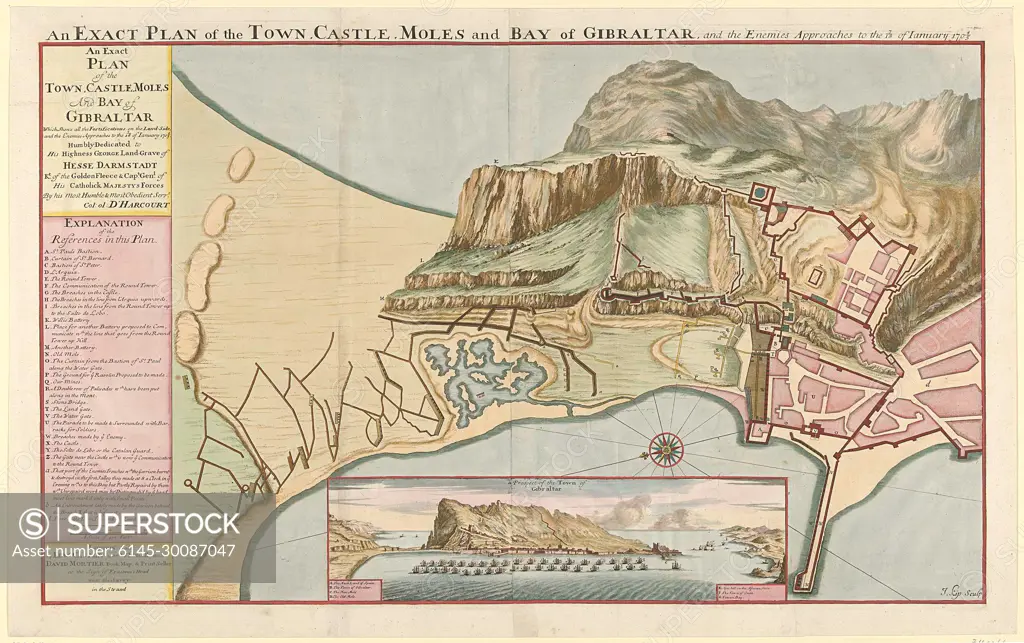
Kaart van Gibraltar, 1705; An Exact Plan of the Town, Castle, Moles and Bay of Gibraltar, and the Eenemies Approaches to the 7/18 of January 1704/5.Map of Gibraltar, besieged by the French and Spaniards in January 1705. At the bottom of a commitment with a face of Gibraltar. On the left the legend A-Z and A-D in English.
SuperStock offers millions of photos, videos, and stock assets to creatives around the world. This image of Kaart van Gibraltar, 1705; An Exact Plan of the Town, Castle, Moles and Bay of Gibraltar, and the Eenemies Approaches to the 7/18 of January 1704/5.Map of Gibraltar, besieged by the French and Spaniards in January 1705. At the bottom of a commitment with a face of Gibraltar. On the left the legend A-Z and A-D in English. by Piemags/PL Photography Limited is available for licensing today.
Looking for a license?
Click here, and we'll help you find it! Questions? Just ask!
Click here, and we'll help you find it! Questions? Just ask!
DETAILS
Image Number: 6145-30087047Royalty FreeCredit Line:Piemags/PL Photography Limited/SuperStockCollection:PL Photography Limited Contributor:Piemags Model Release:NoProperty Release:NoResolution:2500×1571