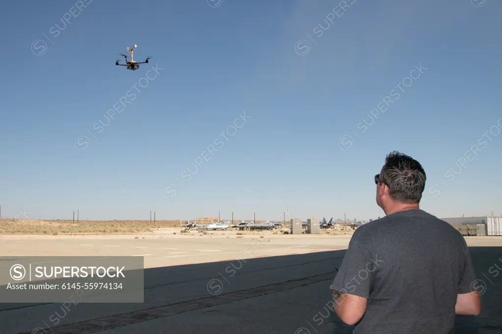
. Justin Link positions the Alta-X aircraft for a hover to capture data as part of the Advanced Exploration of Reliable Operation at Low Altitudes: Meteorology, Simulation and Technology campaign. The campaign was at NASA Armstrong to study wind from the ground to 2,000 feet to provide data to assist future drones to safely land on rooftop hubs called vertiports and to potentially improve weather prediction.
SuperStock offers millions of photos, videos, and stock assets to creatives around the world. This image of . Justin Link positions the Alta-X aircraft for a hover to capture data as part of the Advanced Exploration of Reliable Operation at Low Altitudes: Meteorology, Simulation and Technology campaign. The campaign was at NASA Armstrong to study wind from the ground to 2,000 feet to provide data to assist future drones to safely land on rooftop hubs called vertiports and to potentially improve weather prediction. by Piemags/PL Photography Limited is available for licensing today.
Looking for a license?
Click here, and we'll help you find it! Questions? Just ask!
Click here, and we'll help you find it! Questions? Just ask!
DETAILS
Image Number: 6145-55974134Royalty FreeCredit Line:Piemags/PL Photography Limited/SuperStockCollection:PL Photography Limited Contributor:Piemags Model Release:NoProperty Release:NoResolution:5928×3953