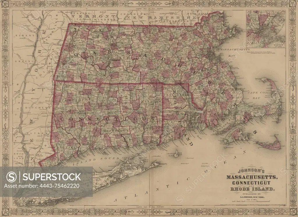
Johnson's map of Massachusetts, Connecticut, and Rhode Island, issued between 1866 and 1869, showcases the administrative and political divisions of this New England region. The hand-colored map measures 40 x 55 cm and is presented on a sheet that measures 46 x 62 cm. Published by A.J. Johnson in New York
SuperStock offers millions of photos, videos, and stock assets to creatives around the world. This image of Johnson's map of Massachusetts, Connecticut, and Rhode Island, issued between 1866 and 1869, showcases the administrative and political divisions of this New England region. The hand-colored map measures 40 x 55 cm and is presented on a sheet that measures 46 x 62 cm. Published by A.J. Johnson in New York by Artokoloro is available for licensing today.
Looking for a license?
Click here, and we'll help you find it! Questions? Just ask!
Click here, and we'll help you find it! Questions? Just ask!
DETAILS
Image Number: 4443-75462220Rights ManagedCredit Line:Artokoloro/SuperStockCollection:Artokoloro Model Release:NoProperty Release:NoResolution:5700×4144