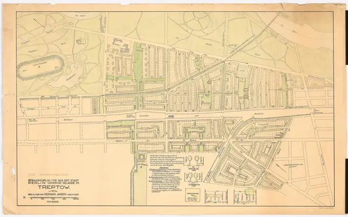
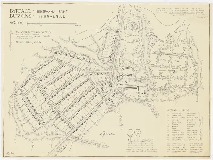
Jansen Hermann (1869-1945), Hagen development plan (1931-1931): Worksheet basic map without altitude lines, department 233, sheet 1: 2000. Lithograph on paper, 77.6 x 102.3 cm (including scan edges) Jansen Hermann (1869-1945): Hagen Bebauungsplan

SuperStock offers millions of photos, videos, and stock assets to creatives around the world. This image of Jansen Hermann (1869-1945), Hagen development plan (1931-1931): Worksheet basic map without altitude lines, department 233, sheet 1: 2000. Lithograph on paper, 77.6 x 102.3 cm (including scan edges) Jansen Hermann (1869-1945): Hagen Bebauungsplan by Piemags/PL Photography Limited is available for licensing today.
Visually Similar More from Urban Development Plans story


Looking for a license?
Click here, and we'll help you find it! Questions? Just ask!
Click here, and we'll help you find it! Questions? Just ask!
DETAILS
Image Number: 6145-48446928Royalty FreeCredit Line:Piemags/PL Photography Limited/SuperStockCollection:PL Photography Limited Story:Urban Development PlansContributor:Piemags Model Release:NoProperty Release:NoResolution:3000×2276