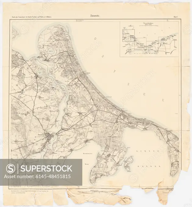
Jansen Hermann (1869-1945), development plan of the city expansion in Swinemünde (1922-1922): Planning documents: Map (1916) of the Baltic Sea coast with the islands of Usedom and Wollin in 4 leaves, sheet 1 (Zinnowitz) 1: 35000. Colored pencil, ink colored, over a break on paper, 71.1 x 65.9 cm (including scan edges) Jansen Hermann (1869-1945): Bebauungsplan der Stadterweiterung, Swinemünde
SuperStock offers millions of photos, videos, and stock assets to creatives around the world. This image of Jansen Hermann (1869-1945), development plan of the city expansion in Swinemünde (1922-1922): Planning documents: Map (1916) of the Baltic Sea coast with the islands of Usedom and Wollin in 4 leaves, sheet 1 (Zinnowitz) 1: 35000. Colored pencil, ink colored, over a break on paper, 71.1 x 65.9 cm (including scan edges) Jansen Hermann (1869-1945): Bebauungsplan der Stadterweiterung, Swinemünde by Piemags/PL Photography Limited is available for licensing today.
DETAILS
Image Number: 6145-48451815Royalty FreeCredit Line:Piemags/PL Photography Limited/SuperStockCollection:PL Photography Limited Contributor:Piemags Model Release:NoProperty Release:NoResolution:2780×3000