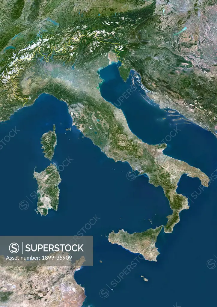
Italy, True Colour Satellite Image With Border. Italy, true colour satellite image with border. Italy comprises the large peninsula at centre, and the large islands of Sicily (lower centre) and Sardinia (centre left). It also encompasses numerous smaller islands. To the northeast of Italy is the Adriatic Sea, southeast of it is the Ionian Sea, southwest of it is the Tyrrhenian Sea, and the Ligurian Sea lies above the French island of Corsica at upper left. The image used data from LANDSAT 5 & 7
SuperStock offers millions of photos, videos, and stock assets to creatives around the world. This image of Italy, True Colour Satellite Image With Border. Italy, true colour satellite image with border. Italy comprises the large peninsula at centre, and the large islands of Sicily (lower centre) and Sardinia (centre left). It also encompasses numerous smaller islands. To the northeast of Italy is the Adriatic Sea, southeast of it is the Ionian Sea, southwest of it is the Tyrrhenian Sea, and the Ligurian Sea lies above the French island of Corsica at upper left. The image used data from LANDSAT 5 & 7 by Universal Images is available for licensing today.
Looking for a license?
Click here, and we'll help you find it! Questions? Just ask!
Click here, and we'll help you find it! Questions? Just ask!
DETAILS
Image Number: 1899-35909Rights ManagedCredit Line:Universal Images/SuperStockCollection: