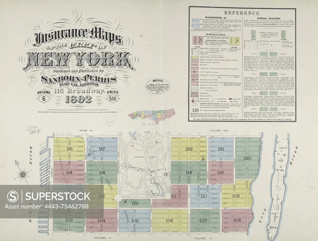
Insurance maps of the City of New York, surveyed and published by Sanborn-Perris Map Co., Limited in 1892. This is Volume 6, which covers the period from 1884 to 1892. These maps focus on fire insurance, real property, and urban layouts in New York State, specifically cities and towns within it
SuperStock offers millions of photos, videos, and stock assets to creatives around the world. This image of Insurance maps of the City of New York, surveyed and published by Sanborn-Perris Map Co., Limited in 1892. This is Volume 6, which covers the period from 1884 to 1892. These maps focus on fire insurance, real property, and urban layouts in New York State, specifically cities and towns within it by Artokoloro is available for licensing today.
Looking for a license?
Click here, and we'll help you find it! Questions? Just ask!
Click here, and we'll help you find it! Questions? Just ask!
DETAILS
Image Number: 4443-75462788Rights ManagedCredit Line:Artokoloro/SuperStockCollection:Artokoloro Model Release:NoProperty Release:NoResolution:6063×4606