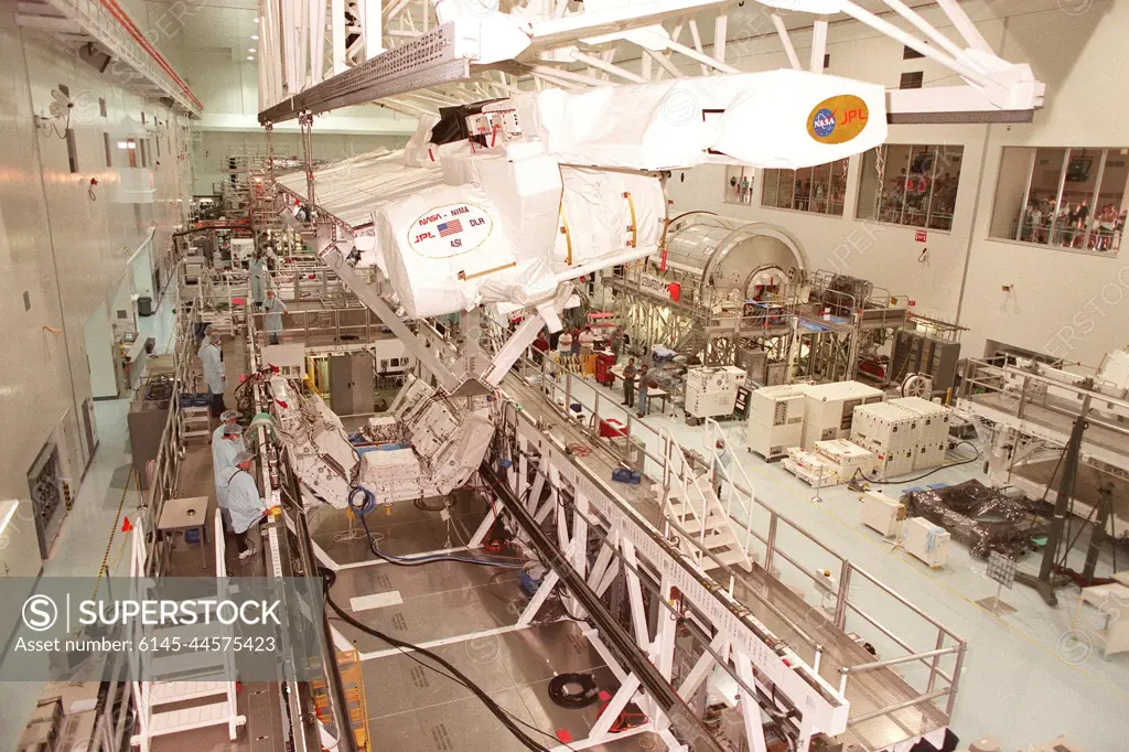
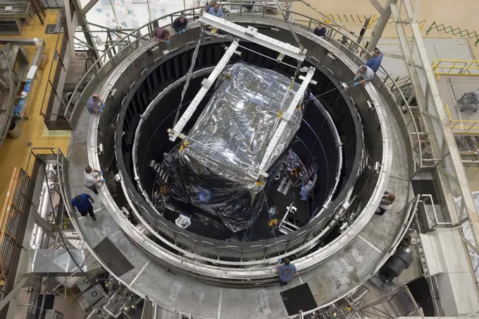
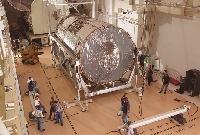
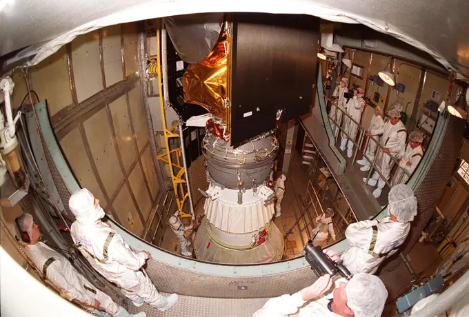
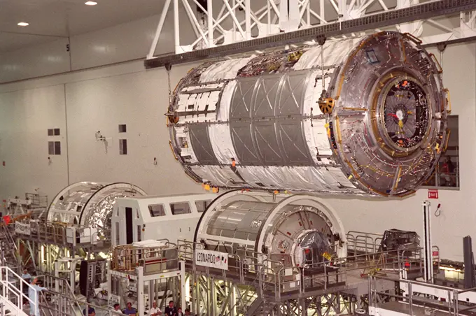
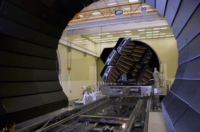
Inside the Space Station Processing Facility, the Shuttle Radar Topography Mission (SRTM) is maneuvered by an overhead crane toward a workstand below. The SRTM, which is the primary payload on mission STS-99, consists of a specially modified radar system that will fly onboard the Space Shuttle during the 11-day mission scheduled for launch in September 1999. The objective of this radar system is to obtain the most complete high-resolution digital topographic database of the Earth. It will gather data that will result in the most accurate and complete topographic map of the Earth's surface that has ever been assembled. SRTM is an international project spearheaded by the National Imagery and Mapping Agency and NASA, with participation of the German Aerospace Center DLR. SRTM will be making use of a technique called radar interferometry, wherein two radar images are taken from slightly different locations. Differences between these images allow for the calculation of surface elevation, or
SuperStock offers millions of photos, videos, and stock assets to creatives around the world. This image of Inside the Space Station Processing Facility, the Shuttle Radar Topography Mission (SRTM) is maneuvered by an overhead crane toward a workstand below. The SRTM, which is the primary payload on mission STS-99, consists of a specially modified radar system that will fly onboard the Space Shuttle during the 11-day mission scheduled for launch in September 1999. The objective of this radar system is to obtain the most complete high-resolution digital topographic database of the Earth. It will gather data that will result in the most accurate and complete topographic map of the Earth's surface that has ever been assembled. SRTM is an international project spearheaded by the National Imagery and Mapping Agency and NASA, with participation of the German Aerospace Center DLR. SRTM will be making use of a technique called radar interferometry, wherein two radar images are taken from slightly different locations. Differences between these images allow for the calculation of surface elevation, or by Piemags/PL Photography Limited is available for licensing today.
Visually Similar More from Space Exploration Technology story
Looking for a license?
Click here, and we'll help you find it! Questions? Just ask!
Click here, and we'll help you find it! Questions? Just ask!
DETAILS
Image Number: 6145-44575423Royalty FreeCredit Line:Piemags/PL Photography Limited/SuperStockCollection:PL Photography Limited Story:Space Exploration TechnologyContributor:Piemags Model Release:NoProperty Release:NoResolution:2617×1743