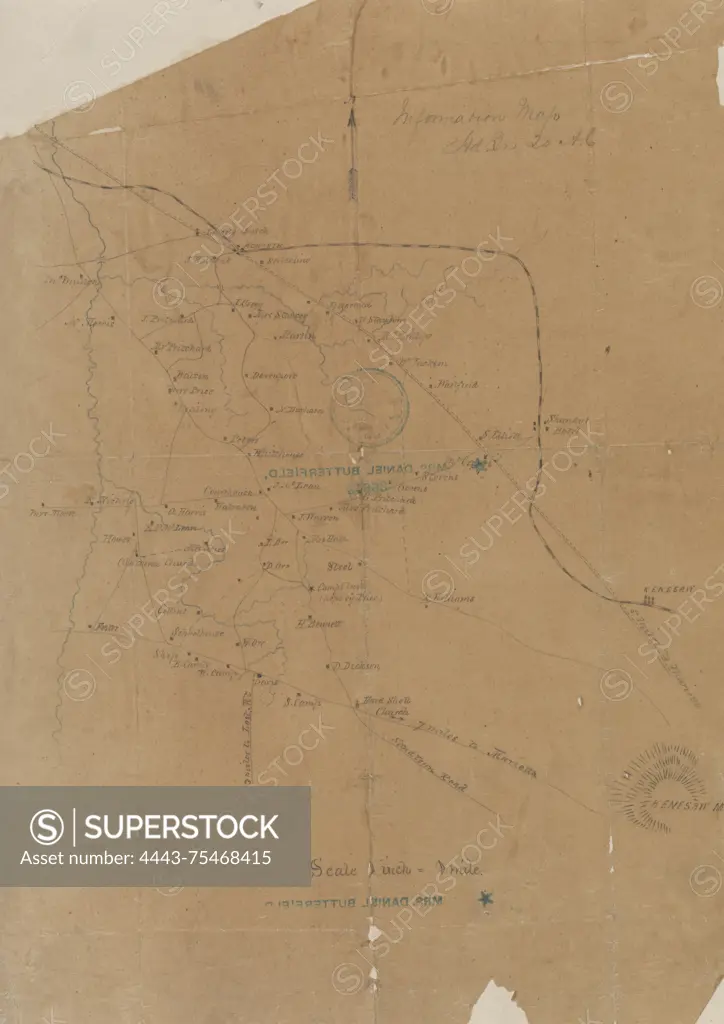
Information map of northwestern Cobb County, Georgia, created in 1864. The map, which measures 41 x 29 cm, is a manuscript and is colored. Relief is indicated by hachures. The publisher is unidentified, and the map includes references to landowners and the Kennesaw Mountain Region in Georgia
SuperStock offers millions of photos, videos, and stock assets to creatives around the world. This image of Information map of northwestern Cobb County, Georgia, created in 1864. The map, which measures 41 x 29 cm, is a manuscript and is colored. Relief is indicated by hachures. The publisher is unidentified, and the map includes references to landowners and the Kennesaw Mountain Region in Georgia by Artokoloro is available for licensing today.
Looking for a license?
Click here, and we'll help you find it! Questions? Just ask!
Click here, and we'll help you find it! Questions? Just ask!
DETAILS
Image Number: 4443-75468415Rights ManagedCredit Line:Artokoloro/SuperStockCollection:Artokoloro Model Release:NoProperty Release:NoResolution:4032×5700