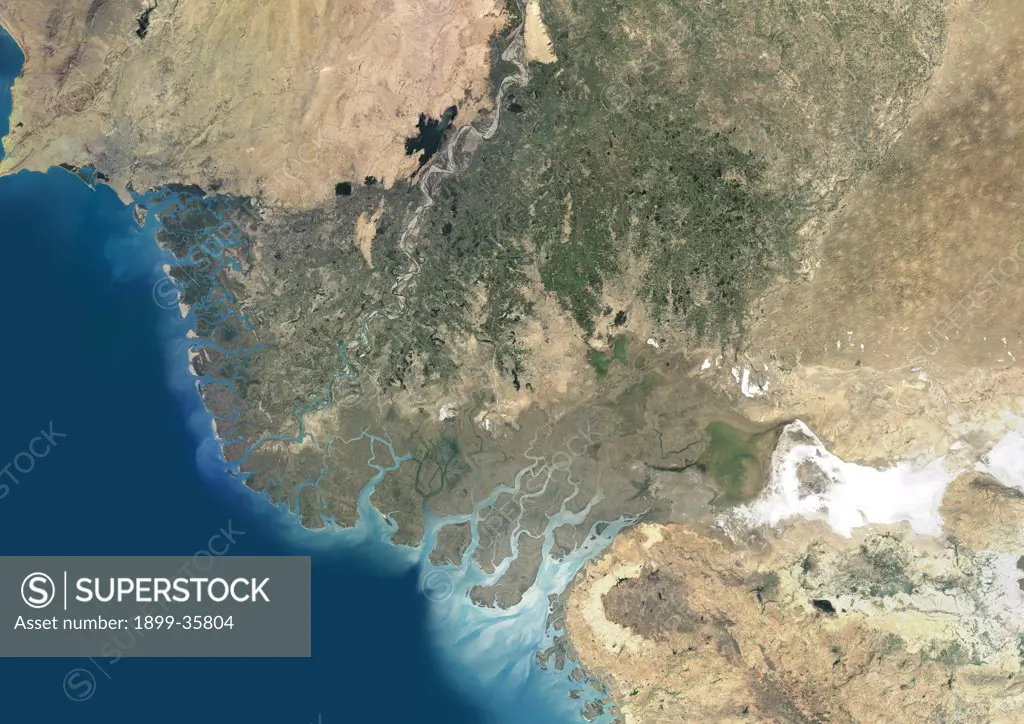
Indus Delta, Pakistan, True Colour Satellite Image. True colour satellite image of the Indus Delta in Pakistan. The Indus River flows into the Arabian Sea near Pakistan's port city of Karachi (top left on the image). The city of Hyderabad, located on the east bank of the Indus River, is on the top centre of the image. India is southeast of the Indus delta. Composite image using LANDSAT 7 data.
SuperStock offers millions of photos, videos, and stock assets to creatives around the world. This image of Indus Delta, Pakistan, True Colour Satellite Image. True colour satellite image of the Indus Delta in Pakistan. The Indus River flows into the Arabian Sea near Pakistan's port city of Karachi (top left on the image). The city of Hyderabad, located on the east bank of the Indus River, is on the top centre of the image. India is southeast of the Indus delta. Composite image using LANDSAT 7 data. by Universal Images is available for licensing today.
Looking for a license?
Click here, and we'll help you find it! Questions? Just ask!
Click here, and we'll help you find it! Questions? Just ask!
DETAILS
Image Number: 1899-35804Rights ManagedCredit Line:Universal Images/SuperStockCollection:Universal Images Model Release:NoProperty Release:NoResolution:4961×3508