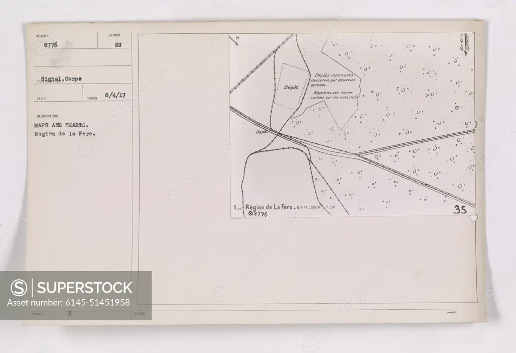
The image depicts a map or chart titled "Region de la Fere." It is a document received and recorded under 111-SC-8776 from the Signal Corps during World War I. The map/chart marked the important supply depots served by various transportations, with many ammunition depots identified in the 60 1 region of La Fère.
SuperStock offers millions of photos, videos, and stock assets to creatives around the world. This image of The image depicts a map or chart titled "Region de la Fere." It is a document received and recorded under 111-SC-8776 from the Signal Corps during World War I. The map/chart marked the important supply depots served by various transportations, with many ammunition depots identified in the 60 1 region of La Fère. by PL Photography Limited is available for licensing today.
Looking for a license?
Click here, and we'll help you find it! Questions? Just ask!
Click here, and we'll help you find it! Questions? Just ask!
DETAILS
Image Number: 6145-51451958Royalty FreeCredit Line:PL Photography Limited/SuperStockCollection:PL Photography Limited Model Release:NoProperty Release:NoResolution:9177×6297