Hydrographic map of the counties of New York, Westchester, and Putnam, issued in 1846. The map, published by N. Currier in New York, shows the line of the Croton Aqueduct. The extent of the map is 17 x 52 cm and includes features related to aqueducts in the New York Metropolitan Area and the Hudson River Valley
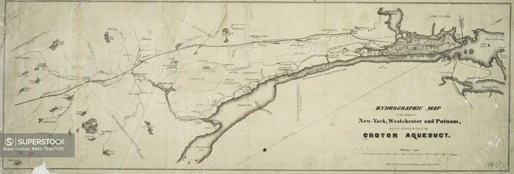
SuperStock offers millions of photos, videos, and stock assets to creatives around the world. This image of Hydrographic map of the counties of New York, Westchester, and Putnam, issued in 1846. The map, published by N. Currier in New York, shows the line of the Croton Aqueduct. The extent of the map is 17 x 52 cm and includes features related to aqueducts in the New York Metropolitan Area and the Hudson River Valley by Artokoloro is available for licensing today.
Looking for a license?
Click here, and we'll help you find it! Questions? Just ask!
Click here, and we'll help you find it! Questions? Just ask!
DETAILS
Image Number: 4443-75467470Rights ManagedCredit Line:Artokoloro/SuperStockCollection:Artokoloro Model Release:NoProperty Release:NoResolution:5295×1796